Categories
Geology News Research

Geoscience’s Ben Gill seeks answer to how the planet changed during Triassic mass-extinction event 200 million years ago

[vc_row][vc_column][vc_column_text]

VT News | October 19, 2020

[/vc_column_text][vc_column_text]

Scientists don’t yet know what caused the Triassic mass-extinction event — one of the largest extinction events in the history of our planet — 200 million years ago. Some scientists point to an asteroid strike; others blame massive volcanic eruptions — each a sudden event; while still others blame a more gradual global climate change and rise in sea levels.

Ben Gill, a geoscientist within the Department of Geosciences in the Virginia Tech College of Science, prefers the volcano scenario. “The volcanic eruptions hypothesis has by far the most support,” he said.

“It’s important to note, however, that those volcanic eruptions would have led to a cascade of environmental changes that would have been bad if you were living on the Earth during that time, such as global warming, deoxygenation of the oceans, and ocean acidification. We still don’t have a good handle on which of these changes played major roles in the extinction event.”

Gill will now use a new, three-year $591,000 National Science Foundation (NSF) grant to — he hopes — solve this riddle. “Evaluating which of these changes were causes of the extinction is part of what we are trying to figure out with this project,” said Gill, an associate professor and an affiliated member of Virginia Tech’s Fralin Life Sciences Institute and Global Change Center.

Ph.D. student Selva Marroquín backpacking to the field site after being dropped off by a bush plane in Wrangell-St. Elias National Park, Alaska. Behind Marraquin is a vat mountain range with clouds.
Ph.D. student Selva Marroquín backpacking to the field site after being dropped off by a bush plane in Wrangell-St. Elias National Park, Alaska. Photo credit: Benjamin Gill


Collaborating on the NSF grant with Gill are researchers from Florida State University and Western Michigan State University, along with international collaborators from Germany, Canada, and the Netherlands in a connected projected.

The study has three core goals:

1)     To determine the longer-term timeline of changes in life and the environment both before and after the extinction. “Most studies have focused on the time just around the mass extinction itself — give or take a few million years. We want to see if there are longer-term trends in the climate and environment that ultimately contributed to the mass extinction,” Gill said.

2)     Determine the role that changing oxygen contents in the oceans had in the extinction event.

3)     And show what changes occurred in life and the environment in an understudied part of the planet. “Most of the studies on this extinction event have looked at locations from a relatively small part of the planet: the Tethys Ocean, an ocean that covered what is now modern-day Europe,” Gill said.

The research team and the mountainside exposures of the sedimentary rocks that preserve end-Triassic mass extinction in Wrangell-St. Elias National Park. the research group is far from the camera dwarfed by the brown-color mountains. Photo credit: Martin Aberhan (Museum für Naturkunde)
The research team and the mountainside exposures of the sedimentary rocks that preserve end-Triassic mass extinction in Wrangell-St. Elias National Park. Photo credit: Martin Aberhan (Museum für Naturkunde)


To accomplish all this, Gill and colleagues are investigating rocks in Alaska that were once sediment on the seafloor located in what was once the Panthalassic Ocean, the ancient version of what we now call the Pacific Ocean.

“There have not been nearly as many studies of what was going on in that ocean during this extinction,” Gill said. “So, the natural questions are: Was the extinction as severe in the Panthalassic Ocean? Is the timing the same as that in the Tethys Ocean? Did the same environmental changes occur in the Panthalassic Ocean as the Tethys?”

To pave the way for the larger NSF funded project, Gill and geosciences doctoral student Selva Marroquín have traveled to the remote Wrangell-St Elias National Park in Alaska three times, in the summers 2017, 2018, and 2019. They are part of international team of researchers from Florida State University, Western Michigan State University, The College of Charleston, the Canadian Geological Survey, Museum für Naturkunde in Berlin, and Utrecht University in The Netherlands.

Fossils of ammonites (an extinct group of cephalopods) collected from the field site in Alaska. This is one group of organisms the were greatly affected by the end-Triassic extinction. Photo credit: Benjamin Gill


A pilot version of this study was funded from the National Geographic Society, and the College of Science’s Dean’s Discovery Fund. The national park in Alaska is so remote, Gill and Marroquín, and the rest of the team were dropped off via a small plane in alpine meadows for two to three weeks at a time.

“Enough was known about the study area to know rocks that preserved the mass extinction were there,” Gill said. “However, this pilot study was needed to establish how viable these remote sites were for a bigger study. They ended up being way better than even we expected.”

Since they were working in a national park, special collection permits were required for the group to collect fossils and rock samples to analyze in the lab. Back at Virginia Tech, geosciences undergraduate students Kayla McCabe and Michael Zigah have been involved in the subsequent lab work looking at the geochemistry of these rock to unlock what they can tell us about this mass extinction.

By understanding the causes and ramifications of this long-ago extinction event, Gill said he and other scientists will learn important context for understanding current and future global changes on our planet, Gill said.

[hr]

CONTACT:

Steven Mackay

540-231-5035

[hr_shadow]

[/vc_column_text][/vc_column][/vc_row]

Categories
Accolades Announcements Biodiversity Geology Research

Sterling Nesbitt receives NSF CAREER award to study the evolution of vertebrate communities during the Triassic Period

[vc_row][vc_column][vc_column_text]

VT News | August 24 2020

[/vc_column_text][/vc_column][/vc_row][vc_row][vc_column][vc_column_text]

Approximately 252 million years ago, 95 percent of all life on Earth was destroyed in what was the largest mass extinction in Earth’s history. But not long after, there was a sudden surge of reptilian diversity that coursed throughout the land, in the oceans, and in the skies.

After receiving a five-year Faculty Early CAREER Development Program award totaling $622,222 from the National Science Foundation, Sterling Nesbitt, an associate professor of geobiology in the Department of Geosciences in the College of Science, and a team of researchers are gearing up for a new field project to learn more about how extinction events — and time itself — drive evolution in vertebrate communities.

“Do communities persist for millions of years? Are the communities that we see outside our very windows always in this state of change or are they pretty stable and it takes a lot of pushing from a natural disaster to move them to a new state?,” asks Nesbitt, an affiliated faculty member of the Fralin Life Sciences Institute and the Global Change Center.

To answer these questions, Nesbitt has chosen to explore a critical time in Earth’s history: the Triassic Period. This time period faced a multitude of catastrophic events, but it was also during this time when key groups of present-day vertebrates — including mammals, turtles, lissamphibians, and squamates — originated.

Associate Professor Sterling Nesbitt poses for. photograph inside Hahn Hall North
Associate Professor Sterling Nesbitt

Nesbitt and his team will focus their efforts on the Petrified Forest National Park. Located in northeastern Arizona, the park is renowned for its giant fossilized trees that date back to the Late Triassic period. Among the trees, paleontologists have found entire fossil communities that have lasted for at least 15 to 20 million years, making this the perfect place to find fossils for their research.

With a team of undergraduate and graduate students, and fellow faculty, Nesbitt will be excavating new fossils from areas within and around Petrified Forest National Park. In addition to collecting new data, the team will visit museums and institutions that already have information from this area, such as the University of California, Berkeley and the American Museum of Natural History.

“As paleontologists, our work is almost detective-like, and our hypotheses about how animals lived and interacted can only be based on the fossils, and therefore, the data we collect,” said Michelle Stocker, an assistant professor of geobiology in the Department of Geosciences, and also an affiliated faculty member of the Fralin Life Sciences Institute and the Global Change Center.

“By focusing on the interconnectivity of these precise locations and time periods, and collecting both large and small fossil remains, we will be able to construct a much richer and more accurate idea of the types or lack of changes that occurred during the Triassic,” Stocker added.

A Virginia Tech team of paleontologists -- composed of undergraduates and graduate students, and faculty -- excavate a rich fossil site from the Triassic Period at Petrified Forest National Park. In the photo, the fossil diggers have their backs to the camera as they work on rocky terrain under a blue sky. Photo courtesy of Sterling Nesbitt.
A Virginia Tech team of paleontologists — composed of undergraduates and graduate students, and faculty — excavate a rich fossil site from the Triassic Period at Petrified Forest National Park. Photo courtesy of Sterling Nesbitt.

The team will also conduct an extension of the Discoveries in Geosciences (DIG) Field School, a K-12 education program created by University of Washington, which brings STEM teachers out to Petrified Forest National Park, where they work alongside researchers. Then they can apply what they have learned to paleontology-related activities in the classroom.

Most teachers from the original program represent the northwestern United States. In an effort to increase diversity, the team will be recruiting teachers from the southeastern United States and Native American groups throughout the southwest, specifically the Zuni and the Navajo Nesbitt said.

“Our hypothesis is that the communities are actually really similar for a really long period of time. In the Triassic, it was essentially the same community again and again but with slightly different species. They looked really similar and probably had similar ecological roles,” said Nesbitt.

-Written by Kendall Daniels of the Fralin Life Sciences Institute.

Related stories

Virginia Tech paleontologist finds, names new 3-foot-tall relative of Tyrannosaurus rex

Two College of Science faculty members receive 2019 SCHEV Outstanding Faculty Award

[/vc_column_text][/vc_column][/vc_row]

Categories
Blog Geology IGC Interfaces of Global Change IGEP Postcards Research Student Spotlight Water

Postcard from a Fellow: Amanda Pennino in the White Mountains of New Hampshire

[vc_row][vc_column][vc_column_text]

By Amanda Pennino |  August 25, 2020

[/vc_column_text][/vc_column][/vc_row][vc_row][vc_column width=”1/3″][vc_column_text]Hi everyone! I hope this e-postcard finds you healthy and energized for the upcoming semester!  My name is Amanda, I’m heading into the third year of my Ph.D. program in the Department of Forest Resources and Environmental Conservation. I am writing from Hubbard Brook Experimental Forest, in the beautiful White Mountains of New Hampshire where I study soil and soil water chemistry.[/vc_column_text][/vc_column][vc_column width=”2/3″][vc_single_image image=”51001″ img_size=”500×300″ alignment=”center”][/vc_column][/vc_row][vc_row][vc_column][vc_column_text]Some of my work aims to measure how soil water chemistry changes through time and space, particularly in glaciated forest soils that are still recovering from long-term acid rain inputs. This means running up into the forest after a big rain storm and lugging around a huge water pump to take samples from our well network. I then take these water samples back to the lab and analyze their chemical composition. A lot of my research questions are focused around what role hydrologic dynamics and soil patterning on the landscape play in determining soil water chemistry. A better understanding of the temporal and spatial variability in the chemistry of soil water can give provide key insights to ecosystem processes that are occurring on the landscape (e.g., mineral weathering, water source, plant uptake).[/vc_column_text][/vc_column][/vc_row][vc_row][vc_column][vc_single_image image=”51000″ img_size=”full” add_caption=”yes” alignment=”center”][/vc_column][/vc_row][vc_row][vc_column width=”1/2″][vc_column_text]While the pandemic has certainly thrown a wrench in many people’s research plans, I feel pretty lucky that I’ve been able to work with some of the rich historical datasets from Hubbard Brook when I couldn’t access my site. In fact, working with this data has help shift and redefine my own research questions. Not surprisingly, the start to my fieldwork season has looked quite a bit different this year. The lilacs have long since bloomed, the streams in their driest point of the year, and very few people are on site. When I arrived last spring, Hubbard Brook was buzzing with researchers and field technicians from all over the country. Due to low winter snowpack and dry weather, New Hampshire is officially in a drought.

This is less than ideal for someone trying to measure water chemistry (i.e., me). Even after the passing of Hurricane Isaias, I still was only able to collect deep groundwater as the shallow wells sat dry. I’ve been keeping myself busy conducting soil depth surveys and cleaning up some of the wells that were attacked by bears. I plan on coming back to Hubbard Brook to water sample in October, when it is more reliably wetter.[/vc_column_text][/vc_column][vc_column width=”1/2″][vc_single_image image=”51003″ img_size=”large” add_caption=”yes” alignment=”center”][/vc_column][/vc_row][vc_row][vc_column][vc_single_image image=”51004″ img_size=”full” add_caption=”yes” alignment=”center”][/vc_column][/vc_row][vc_row][vc_column][vc_single_image image=”51006″ img_size=”large” add_caption=”yes” alignment=”center”][vc_single_image image=”51008″ img_size=”large” add_caption=”yes” alignment=”center”][/vc_column][/vc_row][vc_row][vc_column][vc_column_text]Pandemic, drought, bears… the spring and summer of 2020 has given me some big lessons on adaptation and optimism. We are living in a world with a tremendous amount of uncertainty, but with some of creativity and flexibility we will still succeed. Good luck with the upcoming semester everyone![/vc_column_text][/vc_column][/vc_row][vc_row][vc_column width=”1/3″][vc_single_image image=”51009″ img_size=”large” add_caption=”yes” alignment=”center”][/vc_column][vc_column width=”2/3″][vc_single_image image=”51011″ img_size=”large” add_caption=”yes”][/vc_column][/vc_row][vc_row][vc_column][vc_separator][/vc_column][/vc_row][vc_row][vc_column width=”1/4″][vc_single_image image=”45550″][/vc_column][vc_column width=”3/4″][vc_column_text]Amanda Pennino is an Interfaces of Global Change fellow working with Dr. Brian Strahm and Dr. Kevin McGuire in Virginia Tech’s Department of Forest Resources & Environmental Conservation. She is exploring what climatic and local environmental controls might influence shifts in soil water chemistry, particularly around precipitation events. She hopes that her work will contribute to long-term data records at HBEF, a Long Term Ecological Research (LTER) Network site, where her data will complement ongoing studies of mineral weathering rates, recovery of forests to acid deposition, and upslope controls on stream water chemistry.[/vc_column_text][/vc_column][/vc_row][vc_row][vc_column][vc_separator style=”shadow”][/vc_column][/vc_row]

Categories
Biodiversity Blog Geology Global Change IGC Interfaces of Global Change IGEP Postcards Research

Postcard from a Fellow: Ernie Osburn’s year of two summers

[vc_row][vc_column][vc_column_text]

By Ernie Osburn |  July 23, 2020

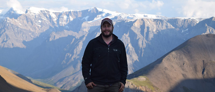
[/vc_column_text][/vc_column][/vc_row][vc_row][vc_column][vc_column_text]Hello everyone! I hope this postcard finds you healthy and safe. If you don’t know me already, I’m Ernie, an IGC fellow from the Biological Sciences department. My research focuses on how landscape history influences soil microbial communities and their ecosystem functions. My goal today is to entertain you with stories about my summer research adventures. Only one problem – this summer has been a weird one. Not sure if you guys have heard, but there is a global pandemic going on right now that has messed up everyone’s summer plans, including my own. As a result, I find myself most days in an empty lab in a mostly empty building doing tedious, mind-numbing lab work. Nothing too exciting to write about, unfortunately . . . However, I was fortunate enough this year to experience two summers: the current northern hemisphere summer as well as the austral (southern hemisphere) summer while doing field work in Antarctica during January and February. Antarctica is much more interesting than Derring Hall, so I’ll write about my time “on the ice.”

My lab mate Sarah and I began our Antarctic adventure on December 12th 2019. Our travels began with about 24 consecutive hours of airline flights from Roanoke, VA to Washington D.C. to Houston, TX, to Auckland, New Zealand, and finally to Christchurch, New Zealand. Because of time zone changes, we lost a day in transit and landed on December 14th. The next day, I attended some training sessions and was issued my extreme cold weather gear (ECW) at the U.S. Antarctic Program facility in Christchurch, NZ. Normally, the flight down to “the ice” is scheduled for the following day, but because of weather delays, we did not fly out until December 17th. The flight was a loud, uncomfortable, 8 hour trip in jump seats on a C-130 with my legs interlocked with those of the people across from me. After the plane landed on the Ross Ice Shelf, we were transported to McMurdo Station.[/vc_column_text][/vc_column][/vc_row][vc_row][vc_column width=”1/2″][vc_single_image image=”50356″ img_size=”large” add_caption=”yes”][/vc_column][vc_column width=”1/2″][vc_single_image image=”50357″ img_size=”large” add_caption=”yes”][/vc_column][/vc_row][vc_row][vc_column][vc_column_text]While in Antarctica, about half of my time was spent living at McMurdo station and processing samples in the lab facility there. McMurdo station is located on Ross Island just off the coast of the Antarctic continent and is the central base of operations for the U.S. Antarctic Program. McMurdo is the most populated place in Antarctica and is essentially a functioning town, complete with a fire department, a water treatment facility, a waste management facility, a library, a hair salon, a general store, and three bars. At its busiest, there were more than 1,200 residents at McMurdo, a mixture of researchers, support staff, and military personnel. Everyone on station eats meals in “the galley,” a big cafeteria. The food is generally all frozen and non-perishable, with fresh food available very rarely. So not the best. People live in very close quarters at McMurdo – everyone is assigned a dorm room with 1-3 roommates and bathrooms are all communal. Also, social life at McMurdo is surprisingly lively. Nearly every night of the week there are events, often involving live music. Most notably is the annual New Year’s Eve concert/party called ‘Ice Stock.’ One interesting quirk of McMurdo is that people like to dress up in silly costumes for these events. There are lots of costume options readily available on station (for reasons unknown to me), so I decided to participate a couple of times after coming across some fun animal costumes. In general, if you thought living in Antarctica would be an isolating experience, you would be very wrong! If you’re interested in learning more about life at McMurdo station, check out the ‘Antarctica: A Year on Ice’ documentary, which is free with Amazon Prime.[/vc_column_text][/vc_column][/vc_row][vc_row][vc_column width=”1/2″][vc_single_image image=”50359″ img_size=”large” add_caption=”yes”][/vc_column][vc_column width=”1/2″][vc_single_image image=”50367″ img_size=”large” add_caption=”yes”][/vc_column][/vc_row][vc_row][vc_column][vc_column_text]The other half of my time in Antarctica was spent living at field camps in the McMurdo Dry Valleys. The Dry Valleys are the largest ice-free areas in Antarctica. For about two months of every year during the austral summer, temperatures get high enough that ice melts, forming streams. These streams flow from glaciers up in the mountains to freshwater lakes at the bottom of each basin. Most of the lake surfaces are covered by a layer of permanent ice, though liquid water ‘moats’ form around the edges of the lakes in the summer months. Most of the lake basins are ‘endorheic,’ meaning they do not have an outflow to the ocean. This causes minerals to accumulate over time, which causes the lakes to form saline layers.[/vc_column_text][/vc_column][/vc_row][vc_row][vc_column width=”1/2″][vc_single_image image=”50354″ img_size=”large” add_caption=”yes”][/vc_column][vc_column width=”1/2″][vc_single_image image=”50358″ img_size=”large” add_caption=”yes”][/vc_column][/vc_row][vc_row][vc_column width=”1/2″][vc_single_image image=”50368″ img_size=”large” add_caption=”yes”][/vc_column][vc_column width=”1/2″][vc_single_image image=”50369″ img_size=”large” add_caption=”yes”][/vc_column][/vc_row][vc_row][vc_column][vc_column_text]The Dry Valleys are located on the Antarctic continent across McMurdo Sound and are only accessible by helicopter. My first trip out to the Dry Valleys was my first time flying in a helicopter and it’s a thrilling experience! While living at the field camps, I slept in a tent each night, which is very difficult with 24 hours of daylight. In fact, I did not see the sun set during my entire two month stay in Antarctica! The field camps also have permanent structures, including small lab spaces and a heated living space with a gas or solar powered appliances such as stoves, ovens, refrigerators, and freezers. The field camps even have wi-fi! The only amenity missing from the field camps is running water, but otherwise living in the camps is surprisingly comfortable. While in the Dry Valleys, Sarah and I hiked to various locations in multiple lake basins to sample soils and microbial mats. These microbial mats are the “forests” of the Dry Valleys and are the most conspicuous life found there. The mats form in lakes, streams, and wet soils, and there are green, red, orange, and black mat varieties, each composed of different microbial taxa. Our goal with these samples is to understand how differences in soil nutrient availability due to the unique geologic histories of the different lake basins has influenced the structure and ecosystem functioning of microbial communities present in these environments.

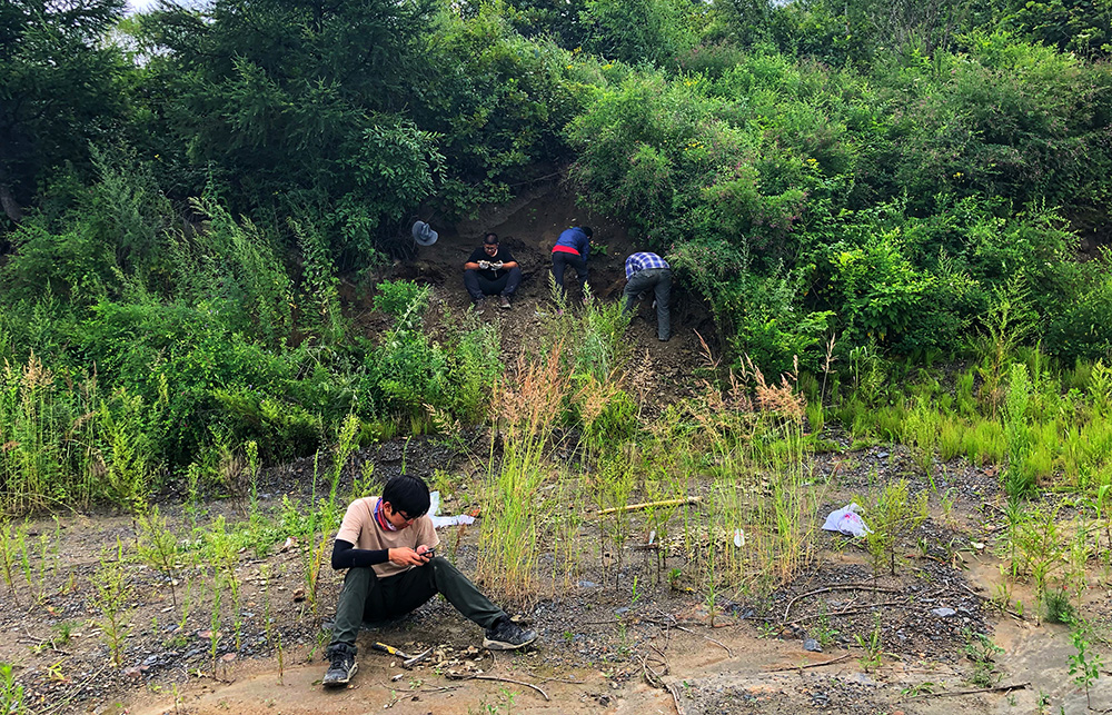
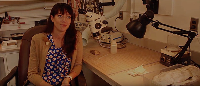
By mid-February, the Antarctic winter was well on its way and it was time for our field season to end. Sarah and I flew back to Christchurch on a US Air Force C-17 and we were then lucky enough to spend a couple of week travelling around New Zealand before coming back to the U.S. As you might imagine, New Zealand is a very different environment from Antarctica and maybe even more stunningly beautiful. It was interesting adjusting back to a more normal society and being surprised at seeing normally mundane things that were not present in Antarctica, such as trees, dogs, children, and the night sky. Then, nearly immediately after arriving back in the U.S., the COVID crisis began and I was stuck in my apartment for a few months working on data analysis and writing.[/vc_column_text][/vc_column][/vc_row][vc_row][vc_column width=”1/2″][vc_single_image image=”50371″ img_size=”large” add_caption=”yes”][/vc_column][vc_column width=”1/2″][vc_single_image image=”50372″ img_size=”large” add_caption=”yes”][/vc_column][/vc_row][vc_row][vc_column][vc_column_text]Now that my 2nd summer is here and our lab has re-opened, I spend most days doing lab processing and analysis of the soil samples we collected in Antarctica and from other projects. My lab work consists of various chemical analyses of soils as well as DNA-based analyses of soil microbial communities. These DNA analyses involve isolation of DNA from the samples and lots of PCR (check out my growing collection of PCR plates below!). The lab work isn’t particularly exciting, but at least it is going smoothly thus far. Anyways, this might be the longest post card in history, so I’m going to stop it here (I’m impressed if you actually read this far!). I hope everyone is doing well during these challenging times and I hope to see everyone soon.[/vc_column_text][/vc_column][/vc_row][vc_row][vc_column width=”1/2″][vc_single_image image=”50373″ img_size=”large” add_caption=”yes”][/vc_column][vc_column width=”1/2″][vc_single_image image=”50374″ img_size=”large” add_caption=”yes”][/vc_column][/vc_row][vc_row][vc_column][vc_separator][/vc_column][/vc_row][vc_row][vc_column width=”1/4″][vc_single_image image=”50375″][/vc_column][vc_column width=”3/4″][vc_column_text]Ernie Osburn is an Interfaces of Global Change fellow working with Dr. Jeb Barrett in Virginia Tech’s Department of Biological Sciences. He is studying the impacts of Rhododendron removals on soil microbial communities and nitrogen cycling in Appalachian forests.[/vc_column_text][/vc_column][/vc_row][vc_row][vc_column][vc_separator style=”shadow”][/vc_column][/vc_row]

Categories
Blog Geology Global Change IGC Interfaces of Global Change IGEP Postcards Research

Postcard from a Fellow: Junyao Kang in the lab with ancient rocks

[vc_row][vc_column][vc_column_text]

By Junyao Kang |  July 10, 2020

[/vc_column_text][/vc_column][/vc_row][vc_row][vc_column width=”1/3″][vc_single_image image=”47782″ img_size=”full”][/vc_column][vc_column width=”2/3″][vc_column_text]Hey folks! I hope everyone is staying safe and healthy. I’m Junyao Kang, a second year Ph.D. student from Department of Geosciences, and one of the newest IGC fellows. This summer, I’m working to analyze some 720-1000-million-years-old carbonate and shale samples, which I gathered in North China last summer. My research focuses on the oceanic environmental changes in deep time and their relationships with the evolution of life. To reconstruct the paleoenvironment and its related change, we rely on the sedimentary rocks forming at that time. The chemical and isotopic compositions of these rocks will tell us what has happened in the seawaters and sediments.

This time interval (about 539-1000 million years ago) is a critical one because it witnessed various eukaryotic innovations and even the origin of animals. Knowing the environmental context will help us better understand what has caused these major evolutionary events and also how the life co-evolved with the environment.[/vc_column_text][/vc_column][/vc_row][vc_row][vc_column][vc_column_text]As I analyze samples this summer, I’m most interested in different iron species incorporated into rocks, because iron is really sensitive to the redox (reduction-oxidation) conditions of the water column. When the water is oxic, iron is mostly incorporated as Fe silicates. However, as it becomes increasingly anoxic, the relative proportion of Fe oxides and Fe carbonates would increase in ferruginous conditions (anoxic and containing free ferrous iron), whereas the relative proportion of Fe sulfides would increase in sulfidic conditions (anoxic and containing free hydrogen sulfide, as is happening deep in the Black Sea right now). Hence, I’m using an iron sequential extraction method to analyze different species of iron preserved in the rocks, which will reflect contemporaneous oceanic redox conditions.

As for isotopic compositions in the samples, I mainly focus on the carbon and sulfur isotopes. Isotopic fractionation will happen during photosynthesis (carbon isotopes) and bacteria using organic matters to reduce sulfate (sulfur isotopes). So isotopic analysis will help us better understand the biogeochemical cycle of carbon and sulfur in ancient oceans. Furthermore, of these two processes, photosynthesis and sulfate reduction, one is directly related to oxygen production while another one actually prevents oxygen being consumed by organic matter oxidation. Therefore, isotopic composition can offer us some information about net oxygen production during that time.[/vc_column_text][/vc_column][/vc_row][vc_row][vc_column][vc_single_image image=”50203″ img_size=”large” add_caption=”yes” alignment=”center” style=”vc_box_shadow_border”][/vc_column][/vc_row][vc_row][vc_column][vc_column_text]Fortunately for me, the COVID pandemic didn’t change my plans too much. But it’s impossible that this pandemic has no effect on my research plan… and quarantined life sometimes drives me crazy :). Because I need to use facilities in different labs within or outside of our department and some of them are still closed, I have needed to modify my research timelines. Also, as a second year student, I’m still learning a lot of lab skills, but the current situation makes it difficult to have some in-situ learning. I hope others are doing well, despite these challenges![/vc_column_text][/vc_column][/vc_row][vc_row][vc_column width=”1/2″][vc_single_image image=”50204″ img_size=”500×400″ add_caption=”yes”][/vc_column][vc_column width=”1/2″][vc_single_image image=”50206″ img_size=”500×400″ add_caption=”yes”][/vc_column][/vc_row][vc_row][vc_column width=”1/2″][vc_single_image image=”50233″ img_size=”500×400″ add_caption=”yes”][/vc_column][vc_column width=”1/2″][vc_single_image image=”50234″ img_size=”500×400″ add_caption=”yes”][/vc_column][/vc_row][vc_row][vc_column][vc_separator][/vc_column][/vc_row][vc_row][vc_column width=”1/4″][vc_single_image image=”50211″][/vc_column][vc_column width=”3/4″][vc_column_text]Junyao Kang is an Interfaces of Global Change fellow in the Geosciences Department under the advisement of Dr. Shuhai Xiao. Junyao hopes to look to the past of the Earth history in order to understand the magnitude, causes, and consequences of global scale anoxia events, which will help to obtain a long view of dead zones, to make long-term predictions, and to develop sustainable strategies to mitigate environmental threats such as dead zones.[/vc_column_text][/vc_column][/vc_row][vc_row][vc_column][vc_separator style=”shadow”][/vc_column][/vc_row]

Categories
Faculty Spotlight Geology Global Change Ideas Seminars, Workshops, Lectures

Creativity, collaboration are key for online instruction

[vc_row][vc_column][vc_column_text]From VT News | March 25, 2020

A mass shift to online instruction has pushed Virginia Tech faculty to develop new ways to teach—a dynamic perhaps nowhere more evident than in GCC affiliate Michelle Stocker’s Morphology of the Vertebrates class in the Department of Geosciences.

Before spring break and the advent of the coronavirus pandemic, Stocker’s class met during big blocks of lab time Mondays and Wednesdays to examine pieces of skeleton laid out on trays across six tables. Students used handouts with figures, a list of appropriate terms, and definitions for specific features and morphological processes seen in the displayed bones.

[/vc_column_text][/vc_column][/vc_row][vc_row][vc_column][vc_column_text]

“They used the figures, terms, and actual specimens to learn the material,” said Stocker, assistant professor of geobiology. “Some can learn by looking at the specimens intensely, and others take to drawing it all out. A lot of students have notebooks in which they draw the different skull elements or specific anatomical views.”

That in-person environment presented a challenge to Stocker when figuring out how to best replicate the class in a distance-learning format. “This class is very much in-person, looking at physical objects,” Stocker said. “It’s quite a transition to be making. I think it’s actually going to work pretty well for the future.”

That successful transition didn’t happen on its own, though. Making it happen took talent, networking, and good old-fashioned Hokie hustle.

“We went into scramble mode a little bit,” Stocker said. “I grabbed the specimens I thought would be most interest or most useful for students to see for the rest of course. I can do in-person demonstrations for them, pointing out different features.”

By “in-person demonstrations,” Stocker is talking about streaming video from her home. As she spoke, the professor was sitting in her basement, surrounded by boxes of bones. As she talked, Stocker plucked specimens and held them up to her web camera.

“Here’s dog skull that’s been prosected by the vet school so we can look at cranial nerves,” Stocker said. “Here are boxes of articulated and disarticulated snakes. An armadillo. Lizards, and other crocodylians. I’ve got a box of hands and feet of mammals on floor, and 3D prints of platypus parts.”

Stocker has built on that foundation of physical specimens with online tools. She’s networked with a colleague at the University of Florida to tap into oVert, a multi-institutional project funded by the National Science Foundation that aims to make available CT scans of all genera of vertebrates, as well as Duke University’s MorphoSource, which has published roughly 27,000 published 3D models of biological specimens.

Stocker and her teaching assistant, Ph.D. candidate Christopher Griffin, are not only drawing on these resources to benefit her students, but they are synthesizing them with her lab demonstrations to develop an engaging distance-learning experience. And she’s doing this while balancing schedules with her husband, Sterling Nesbitt, assistant professor of geobiology in Virginia Tech’s Department of Geosciences, and parenting their three-year-old.

“Flexibility and persistence is what it’s about right now,” Stocker said.

As evolving to the changing landscape of higher education during a pandemic, Stocker and other Virginia Tech faculty are adapting on the fly and building new ways to teach students while also providing a sense of reassurance.

“We want to take care of the students and make sure they’re learning what you want them to learn, but also in times like this we want to make sure they have some sense of normalcy,” Stocker said. “For the group right now, every Monday and Wednesday, we come in and look a skeletons together. We’re keeping that going. We’re doing our job as professors and teachers, and getting them to learn the material, but also just being there for the students.”

In doing so, Stocker and others are showing how Virginia Tech’s motto of Ut Prosim (That I May Serve) not only endures but thrives, even during a pandemic.

For more information about Virginia Tech and its approach to the coronavirus, please read the university’s page on the topic.

— Written by Mason Adams


[/vc_column_text][vc_separator style=”shadow”][/vc_column][/vc_row][vc_row][vc_column][vc_video link=”https://www.youtube.com/watch?v=zLz7F2tOFaw”][/vc_column][/vc_row]

Categories
Biodiversity Blog Faculty Spotlight Geology Global Change Research

Virginia Tech paleontologists identify 1 billion-year-old green seaweed fossils, ancestors to modern land plants

[vc_row][vc_column][vc_column_text]From VT News | February 24, 2020

Virginia Tech paleontologists have made a remarkable discovery in China: 1 billion-year-old micro-fossils of green seaweeds that could be related to the ancestor of the earliest land plants and trees that first developed 450 million years ago.

The micro-fossil seaweeds — a form of algae known as Proterocladus antiquus — are barely visible to the naked eyed at 2 millimeters in length, or roughly the size of a typical flea. Professor Shuhai Xiao said the fossils are the oldest green seaweeds ever found. They were imprinted in rock taken from an area of dry land — formerly ocean — near the city of Dalian in the Liaoning Province of northern China. Previously, the earliest convincing fossil record of green seaweeds were found in rock dated at roughly 800 million years old.

The findings — led by Xiao and Qing Tang, a post-doctoral researcher, both in the Department of Geosciences, part of the Virginia Tech College of Science — are featured in the latest issue of Nature Ecology & Evolution. “These new fossils suggest that green seaweeds were important players in the ocean long before their land-plant descendants moved and took control of dry land,” Xiao said.

A computerized depiction of ancient green seaweed in the ocean, with the fossilized plants in the foreground.
In the background of this digital recreation, ancient microscopic green seaweed is seen living in the ocean 1 billion years ago. In the foreground is the same seaweed in the process of being fossilized far later. Image by Dinghua Yang.


“The entire biosphere is largely dependent on plants and algae for food and oxygen, yet land plants did not evolve until about 450 million years ago,” Xiao said. “Our study shows that green seaweeds evolved no later than 1 billion years ago, pushing back the record of green seaweeds by about 200 million years. What kind of seaweeds supplied food to the marine ecosystem?”

Shuhai said the current hypothesis is that land plants — the trees, grasses, food crops, bushes, even kudzu — evolved from green seaweeds, which were aquatic plants. Through geological time — millions upon millions of years — they moved out of the water and became adapted to and prospered on dry land, their new natural environment. “These fossils are related to the ancestors of all the modern land plants we see today.”

However, Xiao added the caveat that not all geobiologists are on the same page – that debate on the origins of green plants remains debated.Not everyone agrees with us; some scientists think that green plants started in rivers and lakes, and then conquered the ocean and land later,” added Xiao, a member of the Virginia Tech Global Change Center.


There are three main types of seaweed: brown (Phaeophyceae), green (Chlorophyta), and red (Rhodophyta), and thousands of species of each kind. Fossils of red seaweed, which are now common on ocean floors, have been dated as far back as 1.047 billion years old.

“There are some modern green seaweeds that look very similar to the fossils that we found,” Xiao said. “A group of modern green seaweeds, known as siphonocladaleans, are particularly similar in shape and size to the fossils we found.”

Photosynthetic plants are, of course, vital to the ecological balance of the planet because they produce organic carbon and oxygen through photosynthesis, and they provide food and the basis of shelter for untold numbers of mammals, fish, and more. Yet, going back 2 billion years, Earth had no green plants at all in oceans, Xiao said.

Geobiology professor Shuhai Xiao, right, poses for a portrait with his postdoctorate Qing Tang in Derring Hall.
Geobiology professor Shuhai Xiao (right) and postdoctorate researcher Qing Tang in their Derring Hall lab.


It was Tang who discovered the micro-fossils of the seaweeds using an electronic microscope at Virginia Tech’s campus and brought it to Xiao’s attention. To more easily see the fossils, mineral oil was dripped onto the fossil to create a strong contrast.

“These seaweeds display multiple branches, upright growths, and specialized cells known as akinetes that are very common in this type of fossil,” he said. “Taken together, these features strongly suggest that the fossil is a green seaweed with complex multicellularity that is circa 1 billion years old. These likely represent the earliest fossil of green seaweeds. In short, our study tells us that the ubiquitous green plants we see today can be traced back to at least 1 billion years.”

According to Xiao and Tang, the tiny seaweeds once lived in a shallow ocean, died, and then became “cooked” beneath a thick pile of sediment, preserving the organic shapes of the seaweeds as fossils. Many millions of years later, the sediment was then lifted up out of the ocean and became the dry land where the fossils were retrieved by Xiao and his team, which included scientists from Nanjing Institute of Geology and Paleontology in China.

Related stories

Geosciences’ Shuhai Xiao finds fossils dating back 550 million years, among earliest known displays of animal mobility

Virginia Tech-led study finds oldest footprints of bug dating back 540-plus million years

CONTACT:
Steven Mackay
540-231-5035

[/vc_column_text][/vc_column][/vc_row][vc_row][vc_column][vc_separator style=”shadow”][/vc_column][/vc_row]