Categories
Announcements Conservation Educational Outreach IGC Interfaces of Global Change IGEP Science Communication Water

IGC Fellows, VT Stream Team, and New River Land Trust create educational outreach Stream Box

[vc_row][vc_column][vc_column_text]

March 22, 2021

[/vc_column_text][/vc_column][/vc_row][vc_row][vc_column][vc_column_text]Members of the VT Stream Team outreach committee, including Interfaces of Global Change IGEP fellows, Abby Lewis & Heather Wander, have created a “stream box” as part of an educational outreach initiative.  The stream box, a beautifully hand-painted mailbox located near the Nature Play Space at Blacksburg’s Heritage Park, is filled with activities and ID guides for people of all ages to learn about Tom’s Creek.  The project is a collaboration with the New River Land Trust, a local non-profit formed to protect farmland, forests, open spaces and historical places in Virginia’s New River region, and their Youth Education program, which also stewards the Nature Play Space at Heritage Park.

The Stream Team Outreach committee initially headed out to Tom’s Creek for a trash clean-up endeavor last fall, but didn’t find any trash to remove!  They instead chatted with a family by the creek to inquire what they might like to see related to environmental outreach in the area.  The family recommended ID guides – they loved to come out to the creek to explore but didn’t have the knowledge or resources needed to identify what they find.  This encounter sparked the idea for the Stream Box project.  The Stream Team group then reached out to the New River Land Trust outreach coordinator, Melissa “Mel” Henry, to pitch the idea and collaborate.  Mel helped with obtaining permission from the Town of Blacksburg Parks & Recreation department, designing educational materials, and also connected the group with Will Lattea, the Environmental Management Specialist for the Town of Blacksburg, who provided photos and resource ideas for the box.

What’s in the Stream Box?  One activity is designed to help kids observe how different sections of the stream move faster than others by “experimenting” with sticks in the water.  Another activity, called “Hear, See, Smell, Touch” asks kids to slowly and carefully make observations about the world around them.  Also included are scavenger hunts, a tutorial for how to use the iNaturalist app, basic ID guides for plants, reptiles and amphibians, and macro-invertebrates that are likely to be observed near the stream.[/vc_column_text][vc_column_text]Substantial contributions to this project were made by Grace O’Malley, Jared Conner, Katherine Pérez Rivera, and Abby Lewis, all from the VT Stream Team.  Heather Wander, Tadhg Moore, and Adrienne Breef-Pilz also helped brainstorm projects ideas last fall.  Funding for the project is provided by the VT Stream Team. [/vc_column_text][/vc_column][/vc_row][vc_row][vc_column width=”1/2″][vc_single_image image=”54887″ img_size=”large”][vc_single_image image=”54905″ img_size=”large” add_caption=”yes” alignment=”center”][vc_single_image image=”54890″ img_size=”large”][/vc_column][vc_column width=”1/2″][vc_single_image image=”54888″ img_size=”large”][vc_single_image image=”54912″ img_size=”large” add_caption=”yes” alignment=”center” style=”vc_box_border”][/vc_column][/vc_row][vc_row][vc_column][vc_separator style=”shadow”][/vc_column][/vc_row]

Categories
Accolades Announcements Drinking water Global Change Research Undergraduate Experiential Learning Water

GCC Undergraduate Research Grant recipient Dexter Howard leads first-author publication from the Carey Lab

[vc_row][vc_column][vc_column_text]

March 1, 2021

[/vc_column_text][/vc_column][/vc_row][vc_row][vc_column width=”2/3″][vc_column_text]Dexter Howard, a former undergraduate researcher (B.S. ’20 in Water: Resources, Policy, and Management) and now PhD student with GCC affiliate Dr. Cayelan Carey, has first-authored a publication of his undergraduate thesis research. The paper, “Variability in fluorescent dissolved organic matter concentrations across diel to seasonal time scales is driven by water temperature and meteorology in a eutrophic reservoir”, published in the journal Aquatic Science February 2021. Read the article here.

Beginning in 2018, Dexter collected weekly samples of organic carbon (OC) in a Roanoke drinking water reservoir, thought to be the drivers of disinfection byproducts (DBPs) in the water column. In 2019, data collection expanded to the sub-hourly level more relevant to the decision-making timescale used by reservoir managers. The team’s analysis and findings of the magnitude and drivers of OC variability in the reservoir are now published in the journal Aquatic Sciences. Dexter’s undergraduate research experience included mentorship by IGC fellow Mary Lofton, GCC faculty in the Reservoir Science Group at VT, and with support from the GCC Undergraduate Research Grant program and the Virginia Water Resource Research Center at VT.

Kudos, Dexter & team![/vc_column_text][/vc_column][vc_column width=”1/3″][vc_single_image image=”54668″ img_size=”large” add_caption=”yes”][/vc_column][/vc_row][vc_row][vc_column][vc_separator style=”shadow”][/vc_column][/vc_row]

Categories
Seminars, Workshops, Lectures Water

Human-Water Systems, a new monthly seminar in spring 2021

[vc_row][vc_column][vc_column_text]

This message is adapted from an announcement from Landon Marston (CEE), on behalf of the Human-Water Systems seminar series leadership committee.

[hr]

Faculty and students at VT are invited to join a new professional networking and research seminar series centered on human-water systems.

Meetings will be held the third Friday of each month from 1-2 pm EST, with the first meeting occurring on Friday, January 15th, 2021.

To participate – please complete this Google Form to be added you to the informational listserv. You will receive an email in early January with additional details and call-in information. Please share this message with any colleagues you think may be interested in participating.

Each meeting will start with two invited speakers, each giving a 15 minute talk followed by a short Q&A. As the seminar title suggests, all talks will be related to human-water systems. In the remaining twenty minutes, participants will breakout into smaller gatherings (4-10 people) to meet new people (and perhaps a few familiar faces) with a shared interest in human-water systems. There will be designated rooms for graduate students to gather and other rooms dedicated for postgraduate researchers (i.e., postdocs, junior and senior faculty, government scientists, etc.) to meet. The goal is to facilitate regular opportunities for you to make new connections that will hopefully lead to fruitful collaborations on papers and proposals.

Human-water systems are defined very broadly and people from all disciplinary backgrounds are strongly encouraged to attend ‘Human-Water Systems Monthly’. As human-water systems are highly complex, stretching across multiple disciplines, we’d like our audience to reflect this. Diverse participants will also increase the likelihood of collaborations forming that might not be possible in traditional conference settings that are well attended by one discipline but not others.

[/vc_column_text][vc_separator style=”dotted”][/vc_column][/vc_row][vc_row][vc_column][vc_column_text]The void of in-person workshops, conferences, and campus visits has limited opportunities to make new connections, form collaborations, and have serendipitous encounters with colleagues you may only see once a year. Early career researchers are particularly impacted by these lack of opportunities since this is a critical time in one’s career to develop a professional network. While several major conferences have made valiant efforts to mimic the in-person experience, the prolonged conference schedule, odd conference hours, and limited opportunities to make meaningful new contacts has left an opening for regular, focused meetings that provide researchers at all career stages a chance to ‘meet-and-greet’ and also allow early career researchers a stage to present their research.

For now, speakers have been schedule through the spring term (January-April). If interest remains high, the seminar will likely invite additional speakers for the summer and/or fall term. If you would be interested in giving an invited talk, please indicate this when you sign up. At least initially, preference will be given to early career faculty and scientists since these invited presentations are the most meaningful at this stage in their career.[/vc_column_text][/vc_column][/vc_row][vc_row][vc_column][vc_separator style=”shadow”][/vc_column][/vc_row]

Categories
Global Change New Publications Research Water

Low oxygen levels in lakes and reservoirs may accelerate global change

[vc_row][vc_column][vc_column_text]

VT News | December 9, 2020

[/vc_column_text][vc_column_text]

 
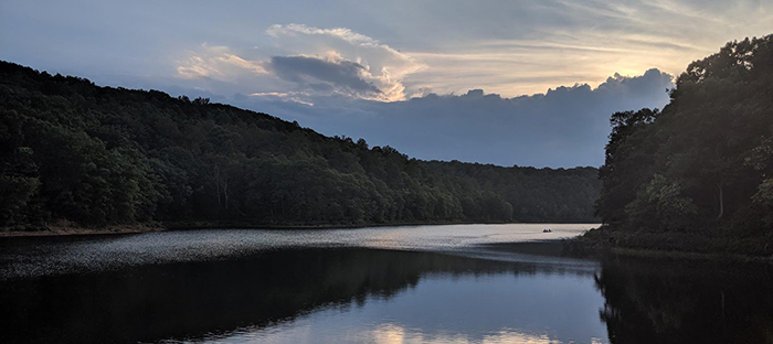
Header image: Beaverdam Reservoir in Vinton, Virginia. Photo courtesy of Alexandria Hounshell.
 

Because of land use and climate change, lakes and reservoirs globally are seeing large decreases in oxygen concentrations in their bottom waters. It is well-documented that low oxygen levels have detrimental effects on fish and water quality, but little is known about how these conditions will affect the concentration of carbon dioxide and methane in freshwaters.

Carbon dioxide and methane are the primary forms of carbon that can be found in the Earth’s atmosphere. Both of these gases are partially responsible for the greenhouse effect, a process that increases global air temperatures. Methane is 34 times more potent of a greenhouse gas than carbon dioxide, so knowing how low oxygen levels within lakes and reservoirs affect both carbon dioxide and methane could have important implications for global warming.

Until now, researchers did not have any empirical data from the whole-ecosystem scale to definitively say how changing oxygen can affect these two greenhouse gases.

“We found that low oxygen levels increased methane concentrations by 15 to 800 times at the whole-ecosystem scale,” said Alexandria Hounshell, a postdoctoral researcher in the Department of Biological Sciences in the College of Science. “Our work shows that low oxygen levels in the bottom waters of lakes and reservoirs will likely increase the global warming potential of these ecosystems by about an order of magnitude.”

Virginia Tech researchers just published these findings in a high-impact paper in Limnology and Oceanography Letters.

To determine a correlation between oxygen and methane concentrations, researchers honed in on two reservoirs outside of Roanoke. In collaboration with the Western Virginia Water Authority, the research team operated an oxygenation system in Falling Creek Reservoir, which pumps oxygen into the bottom waters and allows researchers to study oxygen concentrations on a whole-ecosystem scale. By also monitoring Beaverdam Reservoir, an upstream reservoir without an oxygenation system, they were able to compare greenhouse gas concentrations in the bottom waters of both reservoirs. They ran the experiment over three years to see how consistent their findings were over time.

“Methane levels were much higher when there was no oxygen in the bottom waters of these reservoirs; whereas the carbon dioxide levels were the same, regardless of oxygen levels,” said Cayelan Carey, associate professor of biological sciences and affiliated faculty member of the Global Change Center. “With low oxygen levels, our work shows that you’ll get higher production of methane, which leads to more global warming in the future.”

This study was one of the first to experimentally test at the whole ecosystem-scale how different oxygen levels affect greenhouse gases. Logistically, it is extremely challenging to manipulate entire ecosystems due to their complexity and many moving parts. Even though scientists can use computer modelling and lab experiments, nothing is as definitive as the real thing.

“We were able to do a substitution of space for time because we have these two reservoirs that we can manipulate and contrast with one another to see what the future may look like, as lower bottom water oxygen levels become more common. We can say with high certainty that we are going to see these lakes become bigger methane emitters as oxygen levels decrease,” said Carey.

According to Hounshell, the strength of their results lie in the study’s expanse over multiple years. Despite having a range of meteorological conditions over the three years, the study affirmed that much higher methane concentrations in low oxygen conditions happen consistently every year, no matter the air temperature.

Ultimately, this study is crucial for how researchers, and the general public, think about how freshwater ecosystems produce greenhouse gases in the future. With low oxygen concentrations increasing in lakes and reservoirs across the world, these ecosystems will produce higher concentrations of methane in the future, leading to more global warming.

Of course, these ecological changes are not just happening in the Roanoke region. Around the globe, a number of studies have pointed to changing carbon cycling in terrestrial and marine ecosystems. However, this study is one of the few to address this phenomenon in lakes and reservoirs, which are often neglected in carbon budgets. This study will fill in these knowledge gaps and shine a spotlight on what we can do as citizens to solve this problem.

This study suggests that keeping lakes from experiencing low oxygen concentrations in the first place could further prevent them from hitting the tipping point, when they start to become large methane producers. Small decisions can add up. For example, decreasing runoff into lakes and reservoirs can prevent the depletion of oxygen in their bottom waters. “Don’t put a ton of fertilizer on your lawn, and be really strategic about how much fertilizer you use and how you use it,” said Hounshell.

And greenhouse gases are just a small part of the bigger picture of how reservoirs function in the global carbon cycle. Currently, the research team is conducting follow-up oxygen manipulation studies to elucidate other components that contribute to ecosystem change. They will continue to monitor oxygen manipulations in the two Roanoke reservoirs to see how the reservoir can affect the ecosystem for the long haul.

This project was funded by the Virginia Tech Institute for Critical Technology and Applied Science, the Fralin Life Sciences Institute at Virginia Tech, and by National Science Foundation grant DEB-1753639.  

[/vc_column_text][vc_separator][vc_column_text]

CONTACT:

Kristin Rose Jutras

(540) 231-6614

[/vc_column_text][vc_separator style=”shadow”][/vc_column][/vc_row]
Categories
Climate Change Faculty Spotlight Research Water

Warmer mountaintops, wetter coasts

[vc_row][vc_column][vc_column_text]

VT News | November 20, 2020

[/vc_column_text][vc_column_text]

At the edge of a retreating glacier, bedrock terrain that has been hidden under layers of ice is seeing light for the first time in several hundred years. On mountain peaks, trees experiencing warmer weather are gradually moving higher than established tree lines. Along Virginia’s coast, sea levels are rising by as much as 1 inch every four years.

These seemingly small changes to our landscapes are the frontiers where two faculty members in the College of Natural Resources and Environment’s Department of Geography are investigating how climate change will impact both the natural world and the communities where we live.

Climate challenges to coastal living

On our coasts, new lines of inquiry are also being fueled by and necessitated by climate change.

As sea levels rise and storms become more frequent and severe, there is an urgent need to understand community-scale responses to accelerating coastal risks. In Virginia, Assistant Professor and Global Change Center affiliate Anamaria Bukvic works with stakeholders to capture their experiences with coastal flooding and the ways they are coping with it, to better inform adaptation and resilience policies and programs.

“We are currently exploring the role of sense-of-place in a household’s decision to stay or move from a coastal community in response to flooding,” explained Bukvic, who teaches a course on the societal impacts of climate change. “We’re also investigating potential tipping points or cascading events on a community and household level that may lead to permanent relocation from flood-affected coastal locations.”

As a human geographer, Bukvic studies interactions between people and places using mixed methods, such as geospatial analysis, interviews, and surveys. She notes that the coronavirus pandemic has presented an obstacle in her efforts to interact with stakeholders.

“A significant portion of my work is done in person with communities and people,” she said. “When we learned this past spring that we could no longer collect data in person, we had to quickly adapt and move all of our primary data collection efforts to different modalities, like mail and online surveys and interviews via Zoom. The silver lining is that COVID-19 has inspired us to innovate and develop new and complementing ways to conduct our research.”

Bukvic further studies the impacts of recurrent or nuisance flooding on households’ decisions to consider relocation.

“While a majority of our respondents state it will take a big disaster like Katrina or Sandy to drive them away, smaller but frequent flood events can also serve as stressors that will gradually push people out of their communities,” she explained. “Even inconveniences like school delays and closures, longer commutes to work, and flooded parking lots can have a significant impact on people’s willingness to relocate.”

Bukvic, a Fellow with the National Center for Atmospheric Research’s Early Career Faculty Innovator Program and associate director of Virginia Tech’s Center for Coastal Studies housed in the Fralin Life Sciences Institute, notes that there are paralleling coastal challenges and responses to climate change threats across the world.

“We conducted a systematic literature review to identify which factors define sense-of-place in the context of natural hazards, disasters, and population mobility,” she said. “Based on our analysis, we developed a new measure of sense-of-place and applied it to rural and urban coastal case study locations in the U.S. and found that some considerations are remarkably similar across the globe. For example, people in rural areas generally have stronger attachments to their community due to greater social cohesion, connections to the land and natural environment, and their cultural identity.”

[/vc_column_text][vc_column_text]

Understanding emerging mountain ecosystems

Professor Lynn Resler researches high elevation ecosystems in North America, studying the dynamics that contribute to alpine tree line vegetation change. An ecological biogeographer, Resler examines current ecological processes taking place in remote locations.

“A lot of my work is predictive: I’m looking at what is happening right now and using that to understand what will happen in the future,” she said. “Understanding pattern-process relationships is key to figuring out how these ecosystems are going to be impacted by climate change.”

Resler, who has nearly 20 years of field experience working above the tree line in the Rocky Mountains as well as high elevation peaks in the Appalachian Mountains, has shown that vegetation characteristics in alpine environments are informed by a complex interplay between terrain topography and interactions taking place between plants and pathogens.

One example can be found in whitebark pine forests in the Rockies, where Resler and her collaborators provided crucial research on the spread of white pine blister rust, caused by an invasive fungal pathogen that moves from gooseberry or currant plants to white pines. While other studies suggested that high-altitude pines in cold, dry climates wouldn’t be affected by the fungus, Resler was able to document the spread of the blight above the tree line.

“Our findings led to a rich trajectory of research,” she noted. “Demonstrating that damage and mortality caused by blister rust inhibits the migration of whitepark pine means that we will see a change in the spatial pattern and function of tree lines throughout the Rockies.”

More recently, Resler, who teaches courses in biogeography and mountain geography, has been researching ecosystems that develop as land becomes exposed in the wake of glacier melt in Montana’s Glacier National Park.

“There is a great deal of research on the retreating of glaciers, but not as much on what is happening on the terrain that is exposed by that retreat,” she explained. “I’m looking at vegetation colonization processes at the forefront of glaciers.”

Resler noted that colonization of that new land is a slow process and one that is informed significantly by what kinds of rock exist underneath the ice.

“Geomorphic processes are an important bottleneck in plant succession in these places,” she said. “Plant colonization is very much tied to the nature of the underlying bedrock and glacial geomorphic processes that break down bedrock.”

Resler noted that on both mountaintop tree lines and glacier edges, climate models, while important, cannot alone predict what developing ecosystems will look like because many factors contribute to species range dynamics, including plant interactions, landscape processes, and invasive species.

“I think there’s an expectation that as glaciers retreat, the ecosystems that develop on newly exposed terrain will be the same as those that currently exist in the surrounding environments. But under changing climate scenarios, there are opportunities for new kinds of plants to colonize. The lags in colonization of surrounding plants are leaving space for invasive species to take hold and may alter the landscape significantly.”

Thinking broadly to meet a complex challenge

Both Bukvic and Resler recognize that the Department of Geography has a crucial role to play in bettering our understanding of the impacts of climate change in both the natural world and the human one.

“One of the advantages of the department is that it is highly interdisciplinary,” Bukvic explained. “We have the necessary skills and expertise to tackle emerging, complex issues, such as climate change and coastal resilience, across various physical and human dimensions.”

“Our students are increasingly aware of emerging climate change issues and are interested in finding solutions for some of the pressing challenges that are already affecting natural, built, and human coastal systems,” she continued. “We have a unique opportunity to shape a new workforce of geographers who are equipped with skills and knowledge to engage in a dialogue on coastal resilience and to actively influence the future of our coasts.”

Resler, who has led undergraduate and graduate students on research trips to Washington’s Cascade Mountains as well as study abroad experiences in Antarctica and New Zealand, notes that cultivating a sophisticated understanding of how various areas of research are interconnected is crucial for understanding climate change.

“I love to help students see the big picture, and field experiences are one of the best ways to achieve this goal,” she said. “I think it’s important to help them navigate broad-concept critical thinking while providing them with hands-on, course-relevant information.”

– Written by David Fleming

[/vc_column_text][vc_separator][vc_column_text]

CONTACT:
Krista Timney
(540) 231-6157

[/vc_column_text][vc_separator style=”shadow”][/vc_column][/vc_row]

Categories
Climate Change Interfaces of Global Change IGEP News Research Water

Study: Land development and climate change threaten clear water lakes, but there is hope for protecting them

[vc_row][vc_column][vc_column_text]

VT News | October 14, 2020

[/vc_column_text][vc_column_text]

Scientists have long known that clear water lakes are in danger from land development, pollutants, run-off from storms, and climate change because of increased nutrient pollutants that lead to algae blooms.

However, a recent study from the Virginia Tech Department of Biological Sciences shows that the negative effects from climate change can be mitigated by limiting nutrient pollution from land development in clear-water lakes.

Algae, of course, are a critical part of lake food webs and the zooplankton that eat them. But too much algae in lakes can cause scums on the water, blocking out sunlight for other life in the lake. When the algae die and decompose, they release more nutrients, which can cause even more algae blooms.

“High nutrient pollution can come from many sources: fertilizers and sewage waste are some of the worst sources of nutrient pollution, as far as having the highest concentration of nutrients,” said Nicole Ward, Interfaces of Global Change IGEP fellow and a doctoral student in biological sciences, part of the Virginia Tech College of Science, who led the study.

Ward worked on the study – recently published in the journal Water Resources Research – alongside mentor Cayelan Carey, an associate professor of biological sciences, Kathleen Weathers, a scientist at the Cary Institute of Ecosystem Studies, in addition to collaborators at Dartmouth College in New Hampshire, Bates College in Maine, and the University of Wisconsin-Madison.

The nutrients Ward and Carey refer to are nitrogen and phosphorus – essential building blocks for life, found in DNA, cells, bones, and energy sources. In freshwater systems, the number of organisms living in the water is dependent on the availability of nitrogen and phosphorus. That’s a double-edged sword.

[/vc_column_text][vc_single_image image=”52241″ img_size=”700×400″ add_caption=”yes” alignment=”center”][vc_column_text]

“Erosion and landslides also transport nutrients. Phosphorus is generally bound to sediment particles, so as sediment enters the water it is bringing phosphorus with it,” Ward said. “So, when we add more nutrients, we can really quickly see a lot more life – which seems like a good thing, right? But too much of a good thing is notgood. So, we get huge algae blooms with high nutrient pollution, this can cause scums on the water, potentially harming plants and fish.”

And there’s another issue: “When the algae inevitably die, their decomposition uses up the oxygen in the water, killing organisms in the water that need oxygen,” Ward added.

Further, Ward and Carey found that the negative effects of land use and climate change on a lake depend on if yearly maximum or average phytoplankton concentrations are studied. Average phytoplankton concentrations, during typical summer conditions, show an increase with either warmer air temperatures or higher nutrient pollution. However, annual maximum phytoplankton concentration – or blooms – only increase with higher nutrient pollution.

In the study, Ward and Carey wrote, “Typical summer phytoplankton concentrations will likely increase with warmer air temperatures due to climate change alone and increase even further when combined with higher nutrient pollution. To maintain clear water lakes, nutrient pollution should be reduced even more than previously thought to compensate for increasing phytoplankton in a warmer climate.”

“Oligotrophic lakes – low-nutrient, clear-water lakes with high transparency – are disappearing due to human activities,” said Carey, an affiliated member of Virginia Tech’s Fralin Life Sciences Institute and the Global Change Center. Most of our understanding about how lakes function is from lakes that have already been degraded, so our goal in this study is to understand what factors affect their water quality to best protect them.”

The study focused on Lake Sunapee in New Hampshire, located near Carey’s alma mater, Dartmouth. It was chosen for its pristine water quality and rural location.

The lake also has a goldmine of data thanks to the hard work of the nonprofit, community-operated Lake Sunapee Protective Association. It has 31 years of water quality data, including statistics from a high-frequency buoy monitor that has collected data at 15-minute intervals since 2007. Ward called the group and its data set “critical” to the study.

Ward simulated conditions under five scenarios using the 31-year period data sets. “This study was all data analytics and modeling,” Ward said. “Modeling enables ‘experimentation’ on ecosystems that are not possible in the real world and overcomes logistical limitations of an experiment as large as a watershed. For example, just consider the time to experimentally test each scenario I did in model space: it would have taken 186 years. Our computational abilities, advances in modeling, and advances in sensor technology is completely changing the way we do environmental science.”

Ward added, “Even though this huge global issue of climate change is happening, and we know it is changing water quality across the globe from other research, we can have hope of saving our clear-water lakes from large changes in water quality if we focus on local nutrient pollution. By limiting nutrient availability in the water, the negative climate effects have less ability to wreak havoc.”

The study was funded by a grant from the National Science Foundation’s Coupled Human Natural Systems program. It was part of a larger project to look at several lakes and their water quality under the banner of the project CNH-Lakes, or the Coupled Natural and Human Systems Project, spearheaded by Carey and fellow Virginia Tech faculty Kelly Cobourn, an associate professor in the Department of Forest Resources and Environmental Conversation, part of the College of Natural Resources and Environment, and Kevin Boyle, a professor in the Department of Agriculture and Applied Economics in the College of Agriculture and Life Sciences.

Related stories

To ensure safe drinking water, experts forecast the health of lakes and reservoirs

Study explores connections between land management, water quality, and human response in lake catchments

[/vc_column_text][/vc_column][/vc_row][vc_row][vc_column][vc_column_text]

[hr]

CONTACTS:

Steven Mackay

540-231-5035

[hr_shadow]

[/vc_column_text][/vc_column][/vc_row][vc_row][vc_column][/vc_column][/vc_row][vc_row][vc_column][/vc_column][/vc_row][vc_row][vc_column][vc_separator style=”shadow”][/vc_column][/vc_row]
Categories
Blog Geology IGC Interfaces of Global Change IGEP Postcards Research Student Spotlight Water

Postcard from a Fellow: Amanda Pennino in the White Mountains of New Hampshire

[vc_row][vc_column][vc_column_text]

By Amanda Pennino |  August 25, 2020

[/vc_column_text][/vc_column][/vc_row][vc_row][vc_column width=”1/3″][vc_column_text]Hi everyone! I hope this e-postcard finds you healthy and energized for the upcoming semester!  My name is Amanda, I’m heading into the third year of my Ph.D. program in the Department of Forest Resources and Environmental Conservation. I am writing from Hubbard Brook Experimental Forest, in the beautiful White Mountains of New Hampshire where I study soil and soil water chemistry.[/vc_column_text][/vc_column][vc_column width=”2/3″][vc_single_image image=”51001″ img_size=”500×300″ alignment=”center”][/vc_column][/vc_row][vc_row][vc_column][vc_column_text]Some of my work aims to measure how soil water chemistry changes through time and space, particularly in glaciated forest soils that are still recovering from long-term acid rain inputs. This means running up into the forest after a big rain storm and lugging around a huge water pump to take samples from our well network. I then take these water samples back to the lab and analyze their chemical composition. A lot of my research questions are focused around what role hydrologic dynamics and soil patterning on the landscape play in determining soil water chemistry. A better understanding of the temporal and spatial variability in the chemistry of soil water can give provide key insights to ecosystem processes that are occurring on the landscape (e.g., mineral weathering, water source, plant uptake).[/vc_column_text][/vc_column][/vc_row][vc_row][vc_column][vc_single_image image=”51000″ img_size=”full” add_caption=”yes” alignment=”center”][/vc_column][/vc_row][vc_row][vc_column width=”1/2″][vc_column_text]While the pandemic has certainly thrown a wrench in many people’s research plans, I feel pretty lucky that I’ve been able to work with some of the rich historical datasets from Hubbard Brook when I couldn’t access my site. In fact, working with this data has help shift and redefine my own research questions. Not surprisingly, the start to my fieldwork season has looked quite a bit different this year. The lilacs have long since bloomed, the streams in their driest point of the year, and very few people are on site. When I arrived last spring, Hubbard Brook was buzzing with researchers and field technicians from all over the country. Due to low winter snowpack and dry weather, New Hampshire is officially in a drought.

This is less than ideal for someone trying to measure water chemistry (i.e., me). Even after the passing of Hurricane Isaias, I still was only able to collect deep groundwater as the shallow wells sat dry. I’ve been keeping myself busy conducting soil depth surveys and cleaning up some of the wells that were attacked by bears. I plan on coming back to Hubbard Brook to water sample in October, when it is more reliably wetter.[/vc_column_text][/vc_column][vc_column width=”1/2″][vc_single_image image=”51003″ img_size=”large” add_caption=”yes” alignment=”center”][/vc_column][/vc_row][vc_row][vc_column][vc_single_image image=”51004″ img_size=”full” add_caption=”yes” alignment=”center”][/vc_column][/vc_row][vc_row][vc_column][vc_single_image image=”51006″ img_size=”large” add_caption=”yes” alignment=”center”][vc_single_image image=”51008″ img_size=”large” add_caption=”yes” alignment=”center”][/vc_column][/vc_row][vc_row][vc_column][vc_column_text]Pandemic, drought, bears… the spring and summer of 2020 has given me some big lessons on adaptation and optimism. We are living in a world with a tremendous amount of uncertainty, but with some of creativity and flexibility we will still succeed. Good luck with the upcoming semester everyone![/vc_column_text][/vc_column][/vc_row][vc_row][vc_column width=”1/3″][vc_single_image image=”51009″ img_size=”large” add_caption=”yes” alignment=”center”][/vc_column][vc_column width=”2/3″][vc_single_image image=”51011″ img_size=”large” add_caption=”yes”][/vc_column][/vc_row][vc_row][vc_column][vc_separator][/vc_column][/vc_row][vc_row][vc_column width=”1/4″][vc_single_image image=”45550″][/vc_column][vc_column width=”3/4″][vc_column_text]Amanda Pennino is an Interfaces of Global Change fellow working with Dr. Brian Strahm and Dr. Kevin McGuire in Virginia Tech’s Department of Forest Resources & Environmental Conservation. She is exploring what climatic and local environmental controls might influence shifts in soil water chemistry, particularly around precipitation events. She hopes that her work will contribute to long-term data records at HBEF, a Long Term Ecological Research (LTER) Network site, where her data will complement ongoing studies of mineral weathering rates, recovery of forests to acid deposition, and upslope controls on stream water chemistry.[/vc_column_text][/vc_column][/vc_row][vc_row][vc_column][vc_separator style=”shadow”][/vc_column][/vc_row]

Categories
Biodiversity Blog Conservation Faculty Spotlight Global Change Science Communication Uncategorized Water

One fish, two fish: merging marine animal tracking with fishing fleet movements

[vc_row][vc_column][vc_column_text]

VT News | August 19, 2020

[/vc_column_text][/vc_column][/vc_row][vc_row][vc_column][vc_column_text]


The Food and Agriculture Organization of the United Nations estimated in 2018 that 34.2 percent of the world’s fish stocks were overfished, a worrying trend that has significant impacts on ocean environments and the fishing industries that utilize them.

Satellite technology has increased the capacities of researchers and scientists to collect data about marine animals while tracking the movements of commercial fishing vessels, two crucial drivers in the effort to maintain a healthy ocean ecosystem.

Virginia Tech collaborated with Stanford University and Global Fishing Watch to host “Fish and Ships,” an online workshop connecting researchers from around the world to discuss ways in which the merging of these two data sets might answer critical questions about human impacts on ocean biodiversity and sustainability. Participants brainstormed research approaches on overlapping species habitat maps with the data for national fishing fleet positions and discussed how emerging technologies can better model ocean dynamics.

“We’re in a new age in fisheries management,” said Assistant Professor Francesco Ferretti, of Virginia Tech’s College of Natural Resources and Environment, who coordinated the workshop. “Just a few years ago we had to rely mostly on what the fishers were telling us. Now we have a huge amount of data from satellites that track marine fishing vessels. From that data we can use models to track, predict, and characterize fishing operations around the world.”

Much of the fishing vessel data discussed was provided by Global Fishing Watch, which used the automatic identification system to track the movements of approximately 70,000 industrial fishing vessels from 2012 to 2016, resulting in the first “footprint map” of fishing fleet movement around the world. This map provides a crucial perspective on both the reach of commercial fishing and what drivers are potentially influencing the industry.

At the same time that fishing vessels are “pinging” data about where they are fishing, electronic tags on broad-ranging fish, such as tuna, swordfish, and sharks, are giving scientists new information about the movements of marine animals across the world’s oceans.

“We’re starting to do overlaps of these two data sets to see how much they cross paths,” explained Ferretti, a faculty member in the Department of Fish and Wildlife Conservation. “One goal is to develop a landscape of interactions so we can understand the ways that fishing impacts fish populations. From that information, we can go further, perhaps developing guidelines to help manage the fishing industry and provide data that will improve its efficiency while allowing ocean marine animal populations a chance to recover.”

Ferretti notes that workshop participants particularly enjoyed the opportunity to work collaboratively: “This first workshop has been a great success. We created a consortium of more than 70 scientists from academic institutions, national and international management bodies, and nongovernment organizations, all willing to play ball in making the ocean a more transparent place to use resources and benefit from its services.”

The July workshop served as the kickoff meeting; Virginia Tech is planning to host a second workshop to address the inventorying and integration of large data sets and ongoing analyses.

“We are currently taking steps to invite all these scientists to Virginia Tech,” Ferretti said. “While COVID will likely impact our plans, we are considering numerous hosting options, from our Innovation Campus in Washington, D.C., to our marine facilities on the Chesapeake Bay, to our beautiful campus in Blacksburg. The goal will be a full immersion into the technical aspects of the projects brainstormed during the kickoff meeting.”

Ferretti noted that Virginia Tech has a role to play in protecting and preserving our oceans and hopes that the Fish and Ships venture will prove to be a flagship project towards that effort. The Department of Fish and Wildlife Conservation is currently bolstering its research and educational opportunities in marine fisheries, ecology, and conservation.

“We are a technical university, and right now the ocean requires technical solutions,” said Ferretti, who is affiliated with the Global Change Center housed in Virginia Tech’s Fralin Life Sciences Institute. “There is a great deal of marine technology being developed to understand our oceans better, and Virginia Tech can play a big role in that domain.”


Written by David Fleming

[/vc_column_text][/vc_column][/vc_row]

Categories
Biodiversity Blog Global Change IGC Interfaces of Global Change IGEP Postcards Research Water

Postcard from a Fellow: Daniel Smith’s summer obsession with flumes, fake roots, and Psych

[vc_row][vc_column][vc_column_text]

By Daniel Smith |  August 9, 2020

[/vc_column_text][/vc_column][/vc_row][vc_row][vc_column][vc_column_text]Hi GCC community and friends! Daniel Smith here; I’m a fourth year PhD candidate within the Biological Systems Engineering (BSE) Department and I’ve been an IGC fellow since spring 2019. While at Virginia Tech, my research has focused on how plant roots protect streambank soils from fluvial (water) erosion.  I am interested in understanding which plant root processes/mechanisms have the most influence on streambank erosion. I’m excited to share some of the tools I have been using and testing out this summer that will be used to measure soil erosion in my future experiments.

First, let me introduce the epic, room-sized (26 ft long by 3 feet wide) flume. This flume, housed in ICTAS II (the Institute for Critical Technology and Applied Science), was designed and built to represent water flow within a stream channel. However, a major distinction must be acknowledged between the manmade flume and a natural streambank. The bottom and sides of this flume are made out of smooth, plexiglass material while streams typically have rough bed sediments and grainy bank soil. Many streams also have visible plant roots growing along the streambank face, adding an extra layer to the grainy soil material.  Consequently, to measure the effect of plant roots on streambank erosion in the flume, I need to better represent the boundary conditions found in natural streambank settings.[/vc_column_text][/vc_column][/vc_row][vc_row][vc_column][vc_single_image image=”50732″ img_size=”full” add_caption=”yes”][/vc_column][/vc_row][vc_row][vc_column][vc_column_text]Part of this modification was already done from a previous student’s research project. That student built four “flume inserts” made out of a wooden frame and 1-inch thick PVC sheeting. Sand particles were glued onto the PVC sheets, giving them a grainy texture, and a hole was cut into one of the panels so a soil sample could be placed there for erosion testing. For my experiment, I worked with Allen Yoder in the BSE department to make the testing holes larger, replace some broken and/or missing parts, and fix any worn out sections of the frame. Once inside the flume, these updated walls would represent streambank soil that had no vegetation.[/vc_column_text][/vc_column][/vc_row][vc_row][vc_column width=”1/2″][vc_single_image image=”50729″ img_size=”large” add_caption=”yes”][/vc_column][vc_column width=”1/2″][vc_single_image image=”50763″ img_size=”large” add_caption=”yes”][/vc_column][/vc_row][vc_row][vc_column][vc_column_text]While the sand wall is a good representation of an unvegetated streambank, I still needed something that matched vegetated streambank soils with roots facing the stream channel.  As a result, more PVC sheeting had to be purchased, cut to the correct size, and covered in sand particles. To represent the roots of grassy plants, I decided to use different diameters of flexible, 100% polyester thread. Here’s the fun part: given the size of my PVC sheets, field data from another study revealed I would need ~1500 roots glued onto each insert in order to match what was typically found in the field!  Armed with a hand drill, scissors, thread, and E6000 glue, I drilled 200 holes into each PVC sheet, cut and tied different thread diameters together, and individually glued these fake root bundles into each hole. Once complete, these walls can be drilled on top of the sand wall inserts when I am testing rooted soil planted with grassy-type vegetation. Between the tediously long hours of cutting and gluing, I’ve been able to watch multiple documentaries and an unknown amount of the show Psych![/vc_column_text][/vc_column][/vc_row][vc_row][vc_column][vc_single_image image=”50898″ img_size=”full” add_caption=”yes”][/vc_column][/vc_row][vc_row][vc_column][vc_column_text]But wait…there’s still more! The sand walls will be used to test erosion in unvegetated soil samples and the polyester threaded walls will be used to measure erosion in soil samples planted with grassy vegetation. What about the woody plants?  You guessed it– I’ll need to make another set of walls with fake root material that represents woody (e.g. more rigid) roots. Once that task is completed, I will run some preliminary tests in the flume to make sure the walls are working as desired before the real experiment starts. Needless to say, by the end of this summer, it’s likely that I’ll have watched so many episodes of Psych some of them will start blending together in my head…[/vc_column_text][/vc_column][/vc_row][vc_row][vc_column][vc_single_image image=”50741″ img_size=”large” add_caption=”yes”][vc_single_image image=”50738″ img_size=”large” add_caption=”yes”][/vc_column][/vc_row][vc_row][vc_column width=”1/3″][vc_column_text]In addition to the glorious and time-consuming task of gluing near 800 root bundles (~6000 fake roots in total), I am also taking care of some real plants this summer in the Hahn Horticulture Garden greenhouses. My future experiment will look at using switchgrass (Panicum virgatum) and silky dogwood (Cornus amomum) to represent grassy and woody plant roots. This summer I am testing to see how they grow in these PVC pipe chambers to see if any modifications will need to be made later. So far things are growing nicely![/vc_column_text][/vc_column][vc_column width=”2/3″][vc_single_image image=”50767″ img_size=”large” alignment=”center”][/vc_column][/vc_row][vc_row][vc_column][vc_separator][/vc_column][/vc_row][vc_row][vc_column width=”1/4″][vc_single_image image=”44646″][/vc_column][vc_column width=”3/4″][vc_column_text]Daniel Smith is an Interfaces of Global Change fellow working with Dr. Tess Thompson in Virginia Tech’s Department of Biological Systems Engineering. He is studying how plant roots and soil microorganisms impact streambank soil resistance to fluvial erosion.[/vc_column_text][/vc_column][/vc_row][vc_row][vc_column][vc_separator style=”shadow”][/vc_column][/vc_row]

Categories
Blog Faculty Spotlight Global Change Water

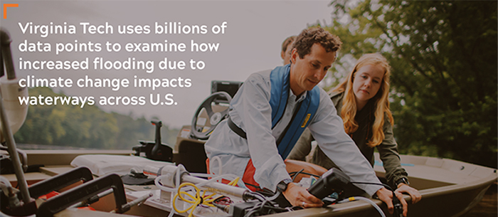
VT researcher uses billions of data points to examine how increased flooding due to climate change impacts US waterways

[vc_row][vc_column][vc_column_text]

From CALS VT News  |  June 30, 2020

There’s a tendency in modern America to think of flooding as nothing but dangerous, a threat to homes, farms, roads, and bridges. But flooding — when the waters of a river rise above the banks and inundate the nearby land — is a natural phenomenon that benefits wildlife habitat and has been crucial for human civilizations ever since the first ones relied on the flooding of the Tigris, Euphrates, and Nile rivers to irrigate their crops.

Durelle Scott, an associate professor of Biological Systems Engineering affiliate of the Global Change Center at Virginia Tech, is the lead author of a paper recently published in the academic journal Nature Communicationsthat examines flooding in the continental United States in nearly unprecedented detail. Scott and his co-authors looked at what Scott calls “everyday” flooding in streams and rivers of all sizes, using data from 5,800 flood monitoring stations operated by the United States Geological Survey. With measurements typically taken every 15 minutes or every 30 minutes, that amounted to more than 2 billion individual measurements. For every station, the team performed 1,000 realizations of flooding thresholds to capture uncertainty, applying statistical techniques on a large computer server.

“The big picture is that flooding across the world is increasing with climate change, but not all flooding is bad and catastrophic,” said Scott, who is in both the College of Agriculture and Life Sciences and the College of Engineering. “We wanted to do an analysis where we captured the variability in annual flooding that occurs within small streams to larger rivers.”

Most flood studies are focused on single river basins or geographic regions, he said. By studying the entire lower 48 states, Scott and his team can examine flooding in both large and small rivers and conclude the entire nation could better manage its floodplains.

Among the paper’s findings: smaller streams flood more often than larger ones, but for shorter durations. The more frequent flooding means that smaller streams serve as a conduit between the landscape and the adjacent stream.

That’s a mixed blessing: “Delivery of nutrients and sediment to floodplain environments is partially why you have very rich soils and agriculture set up along river systems,” Scott said. But the movement of nutrients and sediment goes both ways, and when it moves from the floodplain into the river, it can be harmful to water users downstream.

“When excess nutrients get into a stream or river and are delivered downstream, you end up with algae blooms and the like, and that has implications whether it’s related to human health  or detrimental to commercial or recreational fisheries,” Scott said.

One of Scott’s findings is that the exchange of sediment and nutrients between rivers and floodplains depends not just on the levels of flooding, but on how long a flooding event lasts.

“If you have very short floods, you’ll end up having more net delivery from the floodplain into a river than removal of a specific nutrient or sediment,” Scott said. “That was unique in our study. We were able to quantify approximately how long water was on these floodplains and found for small streams the inundation is usually much less than a day, so there’s not usually an opportunity for removal of nutrients.”

This has implications for wetland restoration intended for water quality benefits. There has been much money and effort spent in recent decades to return rivers and floodplains to something resembling their natural state. This type of restoration, Scott said, must go beyond simply reconnecting a stream to a floodplain, by removing channels or levies that once contained the stream. If the water only tops the stream banks during high flows, flooding will be short and heavy, which could send more harmful material downstream. Instead, restoration within mid-sized rivers may produce more gradual flooding, to achieve what Scott called “the balance of optimal inundation time and nutrient supply for water quality benefits.”

Scott’s research could also have lessons for how we manage rivers to prevent catastrophic flooding. Serious flooding is certainly something to be prevented, but we may be over-protecting ourselves against moderate flooding to enable construction on low-lying floodplains.

“We’ve put in lots of levies to reduce infrastructure damage,” Scott said. “The flipside is if you put up a levy in a town and a town downstream doesn’t have as big of a levy, you’re making it worse for the downstream community. With more frequent flooding on the horizon, future water management needs to balance economic development within flood-prone areas relative to the societal costs of post-flood reconstruction.”


Written by Tony Biasotti

[/vc_column_text][/vc_column][/vc_row][vc_row][vc_column][vc_separator style=”shadow”][/vc_column][/vc_row][vc_row][vc_column][/vc_column][/vc_row]