Categories
Drinking water News Pollution

Hog Farmers Scramble to Drain Waste Pools Ahead Of Hurricane Florence

Just inland from the North Carolina coast, right in the path of Hurricane Florence, there’s an area where there are many more pigs than people. Each big hog farm has one or more open-air “lagoons” filled with manure, and some could be vulnerable to flooding if the hurricane brings as much rain as feared.

Katy Langley lives downstream from many of those farms. “When you fly over the area, you can’t throw a rock without hitting one,” she says. “You see these long barns and these square shapes that are Pepto Bismol pink, because swine waste is bright pink. Fun fact of the day!”

It’s actually bacteria, feeding on the waste, that turn the ponds pink. These lagoons are like a pile of compost. They’re a cheap way to handle animal waste.

But for Langley, the lagoons are a threat. She works for an environmentalist organization called Sound Rivers, and she’s specifically assigned to protect the Neuse River. With thousands of those lagoons just sitting there, open to the weather, with a Category 4 hurricane on the way, Langley is worried that a whole lot of manure is going to wash into the rivers.

Manure lagoons on hog farms like this one in eastern North Carolina flooded after Hurricane Floyd swept through in 1999, creating environmental and health concerns for nearby rivers. Farmers are worried that the scenario will repeat after Hurricane Florence hits this week.
John Althouse/AFP/Getty Images


“We’re probably going to get hit on the nose with this, so flooding’s our biggest concern,” says Marlowe Vaughan of Ivy Spring Creek Farm in Goldsboro, N.C.

The hog houses themselves are safe from flooding, she says, but paths leading to them could be flooded, so that workers will have to get to them by boat.

On her farm, they’re spending part of the day pumping liquid waste out of their lagoons, spraying it as fertilizer on nearby fields, so there’s more room for incoming rainfall.

Experts at North Carolina State University say that if farmers manage to do this ahead of the hurricane, lagoons should be able to handle almost three feet of rain.

But these facilities haven’t ever been forced to accommodate that much rain. I ask Vaughan if the ponds really could handle such a deluge.

“We don’t really know,” she says. “I mean, we try to pump down as much as we can, but after that, it’s kind of in God’s hands. We’re kind of at the mercy of the storm.”

Here’s the really bad scenario: Water starts overflowing and erodes the lagoon wall, causing a wall to collapse, spreading animal waste across the landscape and into rivers.

Rising rivers could also inundate some low-lying lagoons and hog houses. About 60 of them lie within what the state of North Carolina considers the 100-year-flood plain. Animals in those houses may need to be evacuated for the flood waters rise.

There used to be more swine in the flood plain, but after Hurricane Floyd, in 1999, the state bought out some hog farmers in low-lying areas and shut them down.

Some lagoons flooded again during Hurricane Matthew, two years ago, but lagoon walls didn’t collapse.

But Vaughan says, history may not be a guide. It sounds like Florence could be worse. “We really just don’t know,” she says. “We have no idea what’s going to happen. So everybody’s very worried and very concerned. Please pray for us!”

[hr_shadow]

Correction Sept. 11, 2018

A previous Web version of this story said that a state of emergency in North Carolina allows farmers to spray more manure on more fields. This is not the case. The state of emergency does temporarily remove restrictions on the size and weight of trucks carrying livestock, poultry or animal feed.

[hr]

Categories
Climate Change Conservation New Publications News Pollution Research

Land use and pollution shift female-to-male ratios in snapping turtles, raising conservation concerns

[vc_row][vc_column][vc_column_text]

From VT News

Most of us know that our biological sex is decided by the pairing of X and Y chromosomes during conception.

However, for many wildlife species, sex of offspring is determined after fertilization and often influenced by environmental factors, such as temperature. The sex of reptiles, for example, is based on temperatures in the nest while eggs incubate.

Current research shows that increasing global temperatures as a result of climate change are expected to produce more female turtles since their offspring are influenced by the nest’s temperature. But now, a team of Virginia Tech biologists has found that the nesting environment of turtles in agricultural habitats, which can ultimately lower nesting temperatures, can actually produce more males.

To make matters worse, the researchers found that the effect of agricultural activities on sex ratios was exacerbated by the presence of mercury pollution. While it’s known that mercury can impact reproduction in reptiles, this study provides the first documentation that mercury can influence sex determination. The common and pervasive environmental pollutant, when transferred from mother to offspring, was found to increase the number of male offspring even more.

The findings, which were  published in the journal Biological Conservation in June, shed new light on predictions about temperature and sex determination in the snapping turtle, Chelydra serpentina, and many other reptilian species. By examining the impacts of agricultural land use, both independently and interactively with mercury pollution, the research builds new understanding for the complexity of climate-related predictions.

“Our work illustrates how routine human activities can have unexpected side effects for wildlife,” said William Hopkins, professor of wildlife conservation in the College of Natural Resources and Environment and lead researcher of the Wildlife Ecotoxicology and Physiological Ecology Lab at Virginia Tech, who oversaw the study. “We found strong masculinizing shifts in sex ratios caused by the interaction of two of the most common global changes on the planet, pollution and crop agriculture.”

The team worked along the South River in Virginia, where large amounts of mercury persist in the river and floodplain due to leaks from a nearby manufacturing plant into the river from 1929 to 1959. Field experiments were replicated simultaneously in the laboratory using high-resolution temperature profiles to confirm results from the field.

In the field, temperature probes placed in each nest recorded temperature at one-hour intervals throughout the incubation period, mid-May through September. Every eight days, samples were collected to determine soil moisture content, and vegetation growth was monitored for height, density, and ground cover surrounding the nests.

[/vc_column_text][vc_gallery type=”nivo” interval=”3″ images=”25122,25127,25134,25126,25125,25130,25128″ img_size=”400×400″][vc_column_text]Snapping turtles, they found, favor agricultural sites for nesting because they naturally select sun-exposed areas with loose soil, sand, and vegetation debris in which to dig their nests. Females are attracted to the open and sunny agricultural fields in the early summer; the sites quickly become shaded and cooled as dense, monoculture crops grow throughout the season. Cooler incubation temperatures in the nest mean more male offspring are produced.

“Our results indicate that turtles are attracted away from natural nesting habitat into agricultural habitats, and this decision has undesirable consequences for their reproductive success,” said Hopkins. “Turtle populations are sensitive to male-biased sex ratios, which could lead to population declines. These findings are particularly alarming because freshwater turtles are one of the most endangered groups of vertebrates on earth.”

The team also analyzed mercury levels from maternal blood collected in the field as well as one random egg from each nest sampled. They found that higher concentrations of mercury in the mother turtle correlated with the development of more male offspring, and turtles exposed to both mecury and agricultural shade produced the most male offspring.

“These unexpected interactions raise new, serious concerns about how wildlife respond to environmental changes due to human activities. They also add an extra layer of complexity to current projections of climate change,” said Hopkins.

A general best practice for conservation management, according to the researchers, is to incorporate periods of uncultivation for fields in areas known to support a high number of turtle nests. For species of special concern, such as the wood turtle in Virginia, working with landowners to rotate periods of crop growth, implement predator guards, and exercise caution with machinery near identified nests could prevent over-shading and nest damage.

Lead author Molly Thompson, who earned her master’s in fisheries and wildlife sciences at Virginia Tech in 2017, now works as a wildlife biologist at Yosemite National Park. Additional co-authors include Robin Andrews, professor emerita of biological sciences in the College of Science; Brittney Coe, who earned bachelors’ degrees in biological sciences and chemistry in 2009 and a master’s in fisheries and wildlife sciences in 2012 at Virginia Tech; Dean Stauffer, professor of wildlife conservation in the College of Natural Resources and Environment; Daniel Cristol, Chancellor Professor at the College of William & Mary; Dane Crossley, an associate professor of biological sciences at the University of North Texas; and William Hopkins, professor of wildlife conservation at Virginia Tech and director of the Global Change Center at Virginia Tech, a branch of the Fralin Life Science Institute.

This research is supported by the U.S. Fish and Wildlife Service in cooperation with the E.I. DuPont de Nemours and Company.[/vc_column_text][/vc_column][/vc_row][vc_row][vc_column][vc_separator][/vc_column][/vc_row]

Categories
Blog Global Change News Pollution

We’re Drowning In Plastic Trash. Jenna Jambeck Wants To Save Us

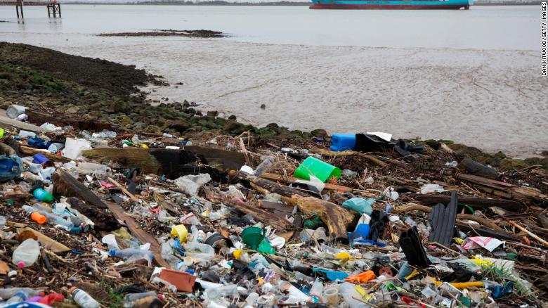
When a huge floating gyre of plastic waste was discovered in the Pacific in the late 1980s, people were shocked. When whales died and washed ashore with stomachs full of plastic, people were horrified. When photographs of beaches under knee-deep carpets of plastic trash were published, people were disgusted.

Though some of it came from ships, most, presumably, was from land. But how much was coming from where?

No one really knew until 2015. That’s when Jenna Jambeck, an environmental engineer at the University of Georgia, did the math. Her groundbreaking study suggested there was hundreds, and perhaps thousands, of times as much plastic washing into the sea as people were seeing in those ocean gyres.

Jambeck’s findings helped galvanize a worldwide movement to stop plastic pollution.

When I first meet the scientist for an interview, I’m not expecting homework. But the first thing she says is: “So what we’re going to do for the next 24 hours is to record everything that you touch that is plastic.”

My microphone has a plastic grip. “So let’s write it down,” she says with a smile and an air of efficiency.

We go through my recording kit: plastic ID card, the zipper on the bag, a plastic data card and the plastic audio recorder …. I can tell this is going to be a long day.

Jambeck started her career as an engineer specializing in solid waste management. She’s become a connoisseur of trash, and what I carelessly call “the dump.”

Landfill!” she says, correcting me.

Her interest in trash started when she was growing up in rural Minnesota, Jambeck says. There was no garbage collection in her area, so she’d borrow a truck to take her family’s trash to the dump every week.

“I was always pretty fascinated by going there and just seeing what I would see,” she remembers. “I fell in love with studying waste.”

Trash, she explains, has a history; each discarded teddy bear or broken bicycle has a story behind it.

We drive out to her favorite landfill, just outside Athens, Ga., and Jambeck makes it clear that we’re not just going to view the garbage pile from afar. We’re going to climb up onto it.

“It’s such a beautiful day out here,” she says. That’s true. The sky is brilliantly blue. There are also vultures hovering overhead, and the aroma is … challenging. The ground is mushy, but that doesn’t slow Jambeck; she came prepared, in green rubber boots.

“All right, I want to go farther,” she says. She wants me to get a better idea of what plastic does in a landfill. Or, rather, what it doesn’t do.

To me, the several-acre mound is a pile of dirt and muck about 50 feet high. Trucks crawl over it, dumping their loads of trash in plastic bags. Miscellaneous objects poke up out of the ground.

But Jambeck sees something different.

“I see, like, a living breathing thing,” she says. “This whole system is actually an ecosystem. Microbes break down the organic garbage into its constituent chemicals. Metal corrodes and dissolves. Almost everything returns to the earth. Except …

“Plastic,” she says with a sigh. “Plastic would be the thing that doesn’t break down.”

It’s the intruder. I look a little closer, and see that almost all the junk on the surface of this pile is made of plastic. “A container of toothpaste,” Jambeck points out. “That looks like the top of a detergent bottle.” There’s PVC pipe. Water bottles. A chip bag.

There are numerous types of plastic. Over time, much of it will break down into smaller pieces. But no one knows how long those pieces linger in the environment.

When people discovered big floating patches of waste plastic in oceans, they wanted to clean it up. Jambeck agrees that the famous giant garbage patch in the Pacific is a nightmare. But upon seeing it, her thought was: Wait a minute. Let’s find out where it’s coming from.

If you leave the tap on and bathwater floods your home, bailing water isn’t the first thing you do, she points out. You shut off the faucet.

“What we can do is keep plastic from going in the ocean in the first place,” she says.

Jambeck worked with a team of scientists at the National Center for Ecological Analysis and Synthesis in California to find the sources of all that plastic. Their seminal paper, published in 2015 in the journal Science, produced new information and astounding numbers.

Most of the trash along beaches and in the ocean is single-use plastic, Jambeck says — cigarette butts, grocery bags, bottles and caps, straws, utensils and packaging. Historically, most of it has been produced in the West, but China is now the top producer, and exporter of plastic goods.

Many countries, including the U.S., contribute plastic pollution, and it all adds up. For example, in 2010 alone (the year’s worth of data that Jambeck’s Science study was based on), a total of 8 million metric tons of plastic entered the world’s oceans.

The research made a big splash. In 2017, the Senate Environment and Public Works Committee invited Jambeck to testify about the problem.

Holding up a bag full of plastic trash, she explained to the senators that 8 million metric tons of plastic is equal to “a volume of five grocery-sized bags filled with plastic for every foot of coastline in the world.”

She predicts the “8 million” could be 10 times as large by 2025, if current trends continue. Half of the waste comes from China, the Philippines, Indonesia and Vietnam. (Note: Though Vietnam puts nearly as much plastic into the ocean per person as China does, the Chinese population is so much greater than Vietnam’s that China’s overall contribution to total plastic in the ocean is much larger).

All these countries have growing consumer economies and haven’t yet developed widespread and efficient methods of waste management. And they have lots of ocean-facing shoreline.

Research shows that the population density along the shoreline largely determines how much trash winds up in the ocean there: more people, more trash.

For Jambeck, the plastic litter in all our lives is a sign of society’s failure.

It’s our era’s footprint, she says. “Is that really the story we want to tell future generations?”

Jambeck is trying to change that story.

Click here to read the full story.

[hr]

Categories
Conservation News Outreach Pollution Science Communication Water

Art aims to make conservation statement

[vc_row][vc_column][vc_separator style=”shadow”][vc_cta h2=”Storm Drain public murals ribbon cutting hosted by Town of Blacksburg” h4=”Tuesday, July 31 at 11:30 am, 300 South Main Street” txt_align=”center” style=”flat”]Four local storm drain art murals will be unveiled at the ribbon-cutting ceremony scheduled for Tuesday, July 31 at 11:30 am. Join Mayor Leslie Hager-Smith in celebrating these four original murals that now decorate the downtown area. The event will kickoff at Marcia’s Park at the corner of Clay Street and Draper Road and will include a brief walking tour to visit each of the four completed murals. Several of the artists will be in attendance to share details on their design concept and process.[/vc_cta][vc_separator style=”shadow”][/vc_column][/vc_row][vc_row][vc_column][vc_column_text]From The Roanoke Times

BY YANN RANAIVO  |  JULY 13, 2018

BLACKSBURG — Ben Oderwald is spending another Friday morning crouched over a storm gutter adjacent to the Wells Fargo branch on the corner of North Main and Jackson streets.

On the sidewalk just above the drain is a colorful scene he painted of a freshwater habitat. Visualized through block-style shapes with thick black outlines, the bottom half of the piece shows a school of fish swimming in a waterway while the top illustrates several amphibians and reptiles set against the backdrop of a blue sky.

Noting the shapes of the animals and the outlines, Oderwald said he drew inspiration from graffiti art for his first ever mural project. He said the piece aims to depict a local scene.

“These are all local fish, amphibians, lizards,” he said before he himself issued a reminder for people to be mindful of what they discard onto the streets. “These things are going to swim in it and live in it.”

Oderwald’s piece is among four storm drain murals that the town of Blacksburg commissioned earlier this year as part of a public art project geared toward ecological stewardship.

The four designs were selected among a total of 55 submissions.

The project aims to bring attention to three things: Blacksburg’s freshwater heritage, the protection of Stroubles Creek and the New River watershed.

Stroubles Creek, which runs through the town, has been noted by local environmentalists over the years for its designation as an impaired waterway.

The murals also unofficially complement another public art project that placed 16 life-size bronze frogs near various Blacksburg landmarks.

“We want to use these platforms as an outreach to the public about water quality issues,” said Carol Davis, Blacksburg’s sustainability manager and the point person on the sidewalk murals project. “People aren’t necessarily aware. If they have a small leak, that ends up on the roadways, then ends up in our storm drain and our watershed.”

Then, Davis said, discarded chemicals can end up in the source of the local drinking supply.

The other three pavement paintings are located over storm drains on

  • Draper Road in front of Bollo’s Cafe;
  • In the parking lot behind Sharkey’s and the Cellar;
  • On Clay Street near the Blacksburg police station.

The town, via funds generated by its stormwater fee, paid each artist a $350 stipend for the work, Davis said. The paint also cost about another $300 per mural, she said.

Shoshana Levenson, who’s about to start her senior year at Virginia Tech, completed the piece in front of Bollo’s.

Her painting depicts the Hokie bird in black standing on a cliff overlooking a valley with a river flowing through the middle the landscape. At the very bottom of the painting, set against a simple black background, is a message painted in white stating “Nothing but rain down the drain.”

Levenson said she drew inspiration for her piece from a vintage national park poster and decided to depict a natural scene of the region in that style. The waterway in her painting, she said, is intended to be the New River.

“It’s just a clear message,” she said about what she wrote at the bottom of the painting just above the drain itself. “I just wanted it to be a clear message: clean water.”

Nicole Hersch, who’s finishing a dual master’s program at Tech in landscape architecture and natural resources, is responsible for the piece behind Sharkey’s and the Cellar.

Hersch’s work is an abstract painting that arranges rectangular and triangular shapes to depict a waterfall and two people, each painted in red, standing in the water below the fall itself.

Hersch previously lived in Northern Virginia and moved to Blacksburg last August. An avid hiker, one of her first treks took her to Giles County’s Cascade Falls, which is represented in her storm drain piece.

“So when this opportunity came up to talk about stormwater, I was immediately drawn due to my experience hiking Cascade Falls,” she said.

Hersch also notes the two people in the water, a part of the piece that she painted just in front of the gutter itself. The message she said she’s relaying there: “One man’s stormwater is another person’s swimming hole.”

The fourth artist is Michael St. Germain, who completed the piece on Clay near the police station.

In a piece similar to Hersch’s and Oderwald’s, St. Germain arranged and painted triangular and rectangular shapes to depict a freshwater scene. In the painting are a turtle, three orange- and red-colored fish with yellow fins and numerous lily pads.

St. Germain used the storm drain cover to paint the center of the turtle’s shell, the outer part of which he spruced up with several short red stripes.

St. Germain couldn’t be reached for comment.

[hr][/vc_column_text][/vc_column][/vc_row]

Categories
News Pollution

Bon Appétit Management Company Bans Plastic Straws Companywide

From BusinessWire

Categories
News Pollution

It’s Not Just Hybrids: Pickup Trucks and Sedans Have Gotten More Efficient, Too

From The New York Times

Categories
News Pollution Uncategorized Water

Ocean plastic predicted to triple within a decade

From CNN

Categories
Pollution Water

‘Dead Zone’ is largest ever in Gulf of Mexico

From National Geographic

A record-breaking, New Jersey-sized dead zone was measured by scientists in the Gulf of Mexico this week—a sign that water quality in U.S. waterways is worse than expected.

The National Oceanic and Atmospheric Administration (NOAA) announced today that this summer’s dead zone is the largest ever recorded, measuring 8,776 miles. This is more expansive than the nearly 8,200 square-mile area that was forecast in July. Since monitoring began 32 years ago, the average size of the Gulf’s dead zone measured in at 5,309 square miles.

The Gulf of Mexico hypoxic or low-oxygen zone, also called a dead zone, is an area of low to no oxygen that can kill fish and other marine life. It’s primarily caused by an excess of agricultural nutrients that flow downstream and into surface waters, stimulating harmful algae.

To record the new measurements and assess the severity of low oxygen levels in the Gulf, scientists from the Louisiana Universities Marine Consortium (LUMCON) embarked on their 31st mid-summer hypoxia research cruise in July. Even with reported numbers as large as they are, the team of scientists said the entire area of the dead zone couldn’t be mapped due to an insufficient number of workable days on the ship. There was more hypoxia to the west, and the measured size would have been larger if there was more time for researchers to work.

“The results from this year reflect the nitrate flux into the Gulf, which was high,” says Nancy Rabalais, a research professor at LUMCON who helped lead the cruise. “It’s a matter of addressing the sources of the nitrate—where they first start—which is in a field of agricultural crops.”

This year’s large size is mainly due to heavy stream flows in May, Rabalais continued, which were about 34 percent above the long-term average and carried higher-than-average amounts of nutrients through Midwest waterways and into the Gulf. (Read “Heavier Rainfall Will Increase Water Pollution in the Future”)

Preliminary reports from the United States Geological Survey (USGS) align with the observation, estimating that 165,000 metric tons of nitrate–about 2,800 train cars of fertilizer—and 22,600 metric tons of phosphorus flowed down the Mississippi and Atchafalaya rivers into the Gulf of Mexico in May.

There are many alternative ways to farm using sustainable agriculture, Rabalais added. Those types of practices can reduce the flux of nitrogen, and they can be economical and beneficial to farming communities.

“It’s a small-scale effort right now that needs to be addressed more formally by the agricultural community,” she says. “I don’t want to see the dead zone get any larger—it’s large enough, and it’s way higher than the target size we want to see.”

What’s Flowing Downstream

The Gulf’s hypoxic zones are caused by excess nutrient pollution, primarily from human activities such as agriculture and wastewater treatment.

Farmland runoff containing fertilizers and livestock waste is the main source of the nitrogen and phosphorus, which stimulate an overgrowth of algae that sinks and decomposes in the water. The resulting low oxygen levels are insufficient to support most marine life and habitats in near-bottom waters, posing a serious threat to the Gulf’s fisheries.

The Gulf dead zone can slow shrimp growth, leading to fewer large shrimp, according to a study led by Duke University. Additionally, the total catch of shrimp could suffer, meaning higher costs at the marketplace and loss of jobs for fishermen, equating to an economic ripple effect on fisheries.

Read the full story at National Geographic


Categories
Global Change Pollution Research

Examining the connection between human health and environment in Central Appalachia

Research team (from left): Emily Satterwhite, Susan West Marmagas, Leigh-Anne Krometis, Linsey Marr, Korine Kolivras, and Julia Gohlke.

From VT News

AUG 2 2017 | Spend enough time driving through Central Appalachia, and you’ll see lush green mountain ranges brimming with diverse plant and animal species. Within those mountains, though, you can also find some of the most dramatic human health disparities in the nation.

Past studies going back to the 1970s indicate heightened incidences of chronic disease and early death in the region. Rates of cancer, cardiovascular disease, and respiratory problems are elevated compared to other regions of the United States, according to an interdisciplinary Virginia Tech research team that spans the sciences and humanities.

In a literature review published in the journal Reviews on Environmental Health, the team argues that more research needs to be conducted to determine how the unique topography and industries of the region, including coal and natural gas, impact the health of people living in the region.

Mountaintop mining in the Appalachian Mountains

So far, a great deal of research has looked at how resource extraction affects biodiversity. Other research has examined the prevalence of lifestyle-related human health issues, such as obesity and type 2 diabetes in the Appalachian region. But relatively little research has examined the connection between resource extraction and human health, the authors write.

The team, which includes researchers from biological systems engineering, civil and environmental engineering, Appalachian studies, geography, and population health sciences, originally assembled in 2014, and then in 2015, received support from a $20,000 seed grant from the Global Change Center at Virginia Tech and the Institute for Society, Culture, and Environment (ISCE).

“Given the complexity of issues affecting people and places in Virginia and beyond, the partnership between the Global Change Center and ISCE is a strategic effort to support and encourage faculty with expertise in the social sciences, biophysical sciences, and engineering to strategically address social aspects of major global change,” said Karen Roberto, director of the Institute for Society, Culture, and Environment.

This support helped them to conduct preliminary research, such as interviews with Appalachian residents and preliminary water and air testing. Their findings during these trips — mostly to Virginia’s Tazewell County — drove them to complete a comprehensive literature review to determine gaps in research thus far.

“Our early site visits and interviews in Appalachia convinced us that there is a connection between the environment and human health that is worth looking into,” said Leigh-Anne Krometis, an associate professor of biological systems engineering in the College of Agriculture and Life Sciences and lead author of the study. “We are grateful to the Global Change Center and ISCE for this early exploratory funding, which has identified a great need and led to a much larger project.”

In June, the team was awarded $75,000 to expand and continue their project for another year under the Global Systems Science Destination Area.  Their project, entitled “Ecological and Human Health in Rural Communities,” will initially focus on Central Appalachia, but may eventually grow to include rural communities worldwide, including portions of India, China, Malawi, and Ecuador, where they could build on existing investments by the university.

The project’s concept paper states, “We are motivated by the [university’s] motto Ut Prosim to serve the surrounding region and fulfill Virginia Tech’s mission as a land grant university with global reach, going ‘beyond boundaries’.” Ut Prosim translates to “That I May Serve.”

“We are supporting this effort because it is in line with the university’s goal of aggressively merging multiple areas of academic excellence — including experimentation, analytics, modeling, and policy — in ways that could result in practical social and environmental benefit while also providing our students opportunities for relevant and meaningful research experiences,” said Dennis Dean, director of the Fralin Life Science Institute.

Globally, more than 3.4 billion people live in rural areas, and these areas remain critical for energy and food production. Published estimates suggest that even under predictions of high natural gas production and low coal demand, almost 1,000 square kilometers of new mine development is expected in the next 20 years in the Central Appalachia region.

“For years, community residents in Central Appalachia have expressed uncertainty and concern regarding the cumulative effects of a variety of factors on human health,” said study coauthor Emily Satterwhite, an associate professor in the Department of Religion and Culture in the College of Liberal Arts and Human Sciences. “Virginia Tech has an important role to play in partnering with local communities to examine and address issues of environmental justice.”

Linsey Marr, a professor of civil and environmental engineering in the College of Engineering and coauthor, studies air pollution and will continue to research links between air quality and human health in the region for the project.

“Rural areas are often neglected in the national discussion about air pollution,” said Marr. “We usually assume that air quality in rural areas is good, but there are different sources of pollution and patterns of human exposure that deserve further study.”

Other authors include Julia Gohlke, an assistant professor of population health sciences in the Virginia–Maryland College of Veterinary Medicine; Korine Kolivras, an associate professor of geography in the College of Natural Resources and Environment; and Susan West Marmagas, an associate professor of population health sciences in the Virginia–Maryland College of Veterinary Medicine.

[hr]

Story by Lindsay Key, Communications Director, Fralin Life Science Institute

Categories
Pollution

Ill winds: open burning of munitions waste at arsenals contaminates local air and land

From ProPublica

by Abrahm Lustgarten

The Pentagon’s handling of munitions and their waste has poisoned millions of acres, and left Americans to guess at the threat to their health.

Shortly after dawn most weekdays, a warning siren rips across the flat, swift water of the New River running alongside the Radford Army Ammunition Plant. Red lights warning away boaters and fishermen flash from the plant, the nation’s largest supplier of propellant for artillery and the source of explosives for almost every American bullet fired overseas.

Along the southern Virginia riverbank, piles of discarded contents from bullets, chemical makings from bombs, and raw explosives — all used or left over from the manufacture and testing of weapons ingredients at Radford — are doused with fuel and lit on fire, igniting infernos that can be seen more than a half a mile away. The burning waste is rich in lead, mercury, chromium and compounds like nitroglycerin and perchlorate, all known health hazards. The residue from the burning piles rises in a spindle of hazardous smoke, twists into the wind and, depending on the weather, sweeps toward the tens of thousands of residents in the surrounding towns.

Nearby, Belview Elementary School has been ranked by researchers as facing some of the most dangerous air-quality hazards in the country. The rate of thyroid diseases in three of the surrounding counties is among the highest in the state, provoking town residents to worry that emissions from the Radford plant could be to blame. Government authorities have never studied whether Radford’s air pollution could be making people sick, but some of their hypothetical models estimate that the local population faces health risks exponentially greater than people in the rest of the region.

More than three decades ago, Congress banned American industries and localities from disposing of hazardous waste in these sorts of “open burns,” concluding that such uncontrolled processes created potentially unacceptable health and environmental hazards. Companies that had openly burned waste for generations were required to install incinerators with smokestacks and filters and to adhere to strict limits on what was released into the air. Lawmakers granted the Pentagon and its contractors a temporary reprieve from those rules to give engineers time to address the unique aspects of destroying explosive military waste.

That exemption has remained in place ever since, even as other Western countries have figured out how to destroy aging armaments without toxic emissions. While American officials are mired in a bitter debate about how much pollution from open burns is safe, those countries have pioneered new approaches. Germany, for example, destroyed hundreds of millions of pounds of aging weapons from the Cold War without relying on open burns to do it.

In the United States, outdoor burning and detonation is still the military’s leading method for dealing with munitions and the associated hazardous waste. It has remained so despite a U.S. Senate resolution a quarter of a century ago that ordered the Department of Defense to halt the practice “as soon as possible.” It has continued in the face of a growing consensus among Pentagon officials and scientists that similar burn pits at U.S. bases in Iraq and Afghanistan sickened soldiers.

Federal records identify nearly 200 sites that have been or are still being used to open-burn hazardous explosives across the country. Some blow up aging stockpile bombs in open fields. Others burn bullets, weapons parts and — in the case of Radford — raw explosives in bonfire-like piles. The facilities operate under special government permits that are supposed to keep the process safe, limiting the release of toxins to levels well below what the government thinks can make people sick. Yet officials at the Environmental Protection Agency, which governs the process under federal law, acknowledge that the permits provide scant protection.

Consider Radford’s permit, which expired nearly two years ago. Even before then, government records show, the plant repeatedly violated the terms of its open burn allowance and its other environmental permits. In a typical year, the plant can spew many thousands of pounds of heavy metals and carcinogens — legally — into the atmosphere. But Radford has, at times, sent even more pollution into the air than it is allowed. It has failed to report some of its pollution to federal agencies, as required. And it has misled the public about the chemicals it burns. Yet every day the plant is allowed to ignite as much as 8,000 pounds of hazardous debris.

“It smells like plastic burning, but it’s so much more intense,” said Darlene Nester, describing the acrid odor from the burns when it reaches her at home, about a mile and a half away. Her granddaughter is in second grade at Belview. “You think about all the kids.”

Internal EPA records obtained by ProPublica show that the Radford plant is one of at least 51 active sites across the country where the Department of Defense or its contractors are today burning or detonating munitions or raw explosives in the open air, often in close proximity to schools, homes and water supplies. The documents — EPA PowerPoint presentations made to senior agency staff — describe something of a runaway national program, based on “a dirty technology” with “virtually no emissions controls.” According to officials at the agency, the military’s open burn program not only results in extensive contamination, but “staggering” cleanup costs that can reach more than half a billion dollars at a single site.

Read the full story at ProPublica

[hr_shadow]